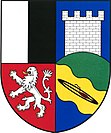
Františkov nad Ploučnicí
| Františkov nad Ploučnicí | ||||
|---|---|---|---|---|
|
||||
| Basic data | ||||
| State : |
|
|||
| Region : | Ústecký kraj | |||
| District : | Děčín | |||
| Area : | 536.6801 ha | |||
| Geographic location : | 50 ° 44 ' N , 14 ° 20' E | |||
| Height: | 216 m nm | |||
| Residents : | 384 (Jan. 1, 2019) | |||
| Postal code : | 407 22-407 23 | |||
| License plate : | U | |||
| traffic | ||||
| Street: | Benešov nad Ploučnicí - Žandov | |||
| Railway connection: | Benešov nad Ploučnicí – Česká Lípa | |||
| structure | ||||
| Status: | local community | |||
| Districts: | 2 | |||
| administration | ||||
| Mayor : | Libor Bzura (as of 2018) | |||
| Address: | Františkov nad Ploučnicí 79 407 23 Františkov nad Ploučnicí |
|||
| Municipality number: | 545899 | |||
| Website : | mesta.obce.cz/web/index.asp?u=3460 | |||
| Location of Františkov nad Ploučnicí in the Děčín district | ||||

|
||||
Františkov nad Ploučnicí (German Franzenthal-Ulgersdorf ) is a municipality in the Czech Republic . It is located ten kilometers southeast of Děčín and belongs to the Okres Děčín .
geography
Geographical location
Františkov nad Ploučnicí is located above the Šarfenštejn castle in the Ploučnice valley . On the left side of the river is Františkov and on the right Oldřichov. In the north rises the Ostrý (300 m), east of the Liščí vrch (351 m), in the southeast of the Kamenec (519 m), south of the Lipový vrch (403 m) and Kohout ( Krohberg , 589 m) and in the northwest of the Sokolský vrch (333 m).
Community structure
The community Františkov nad Ploučnicí consists of the districts Františkov nad Ploučnicí ( Franzenthal-Ulgersdorf ) and Mlatce ( Josefswille ). Basic settlement units are Františkov nad Ploučnicí ( Franzenthal ), Oldřichov ( Ulgersdorf ) and Mlatce.
The municipality is divided into the cadastral districts of Františkov nad Ploučnicí and Oldřichov nad Ploučnicí.
Neighboring communities
Neighboring towns are Dolní Habartice in the north, Malá Bukovina in the north-east, Velká Bukovina , Starý Šachov and Malý Šachov in the east, Valkeřice in the south, Blankartice in the south-west, Mlatce, Bedřichov, Terezínské Údolí and Heřmanovnicí in the west and Benešov nad Ploučnicí in the north-west.
history
Ulgersdorf was first mentioned in 1580 when the village of Bensen became a church of St. Barbara in Sandau was repared. It is assumed that there was also a hereditary court in Ulgersdorf . In 1708 the Franzenthal settlement named after Johann Franz von Thun was built on the corridors of the Meierhof Scharfenstein on the left bank of the Polzen. Franzenthal and Ulgersdorf was attached to the Bensen parish in 1783. In 1792, the Josefswille settlement was laid out to the northwest. In 1833 Franzenthal consisted of 22 houses and had 118 inhabitants. The places belonged to the Scharfenstein rule until 1848 .
After the abolition of patrimonial Franzenthal formed from 1850 a district of the political community Neuland in the district authority of Tetschen .
At that time, several textile factories opened in Franzenthal, and the place grew. Because of its location in the deep river valley, agriculture has always played a subordinate role, and Franzenthal has developed into an industrial community since the 19th century. The Theresiental settlement, named after Therese Mattausch , was established in 1869 as a workers' colony for the Mattausch & Son textile factory . In 1872 the railway line from Bodenbach to Böhmisch Leipa started operations.
In 1900 the community Franzenthal-Ulgersdorf / Františkov-Oldřichov was formed, to which the districts Franzenthal, Josefswille, Neuland, Scharfenstein, Theresiental and Ulgersdorf belonged. In 1930 the community had 1,187 inhabitants. Of these, 523 lived in Franzenthal, 67 in Scharfenstein and 74 in Theresienthal. Neuland was re-municipalityed to Bensen in the 1930s.
After the Munich Agreement , the community was added to the German Reich in 1938 and belonged to the Tetschen (-Bodenbach) district until 1945 . In 1939 there were 1091 people in Franzenthal-Ulgersdorf. In 1945 Franzenthal-Ulgersdorf returned to Czechoslovakia and the German residents were expelled . The village was renamed Františkov nad Ploučnicí in 1946 and was populated by Czechs.
Between 1980 and 1990 Františkov nad Ploučnicí was incorporated into Benešov nad Ploučnicí .
Culture and sights
- Ruins of the Šarfenštejn castle , west of the village in a meander of the Ploučnice
- Chapel in Oldřichov
- Mount Kohout with ruinous lookout tower
Web links
Individual evidence
- ↑ http://www.uir.cz/obec/545899/Frantiskov-nad-Ploucnici
- ↑ Český statistický úřad - The population of the Czech municipalities as of January 1, 2019 (PDF; 7.4 MiB)
- ↑ http://www.uir.cz/casti-obce-obec/545899/Obec-Frantiskov-nad-Ploucnici
- ↑ http://www.uir.cz/zsj-obec/545899/Obec-Frantiskov-nad-Ploucnici
- ↑ http://www.uir.cz/katastralni-uzemi-obec/545899/Obec-Frantiskov-nad-Ploucnici
- ↑ http://portal.gov.cz/wps/portal/_s.155/701/.cmd/ad/.c/313/.ce/10821/.p/8411/_s.155/701?PC_8411_l=123 / 1947 & PC_8411_ps = 10 & PC_8411_text = Fr% C3% BDdlant ( Page no longer available , search in web archives ) Info: The link was automatically marked as defective. Please check the link according to the instructions and then remove this notice.


