Velká Bukovina
| Velká Bukovina | ||||
|---|---|---|---|---|
|
||||
| Basic data | ||||
| State : |
|
|||
| Region : | Ústecký kraj | |||
| District : | Děčín | |||
| Area : | 1435.4436 ha | |||
| Geographic location : | 50 ° 44 ' N , 14 ° 23' E | |||
| Height: | 313 m nm | |||
| Residents : | 507 (Jan. 1, 2019) | |||
| Postal code : | 407 29 | |||
| License plate : | U | |||
| traffic | ||||
| Street: | Žandov - Česká Kamenice | |||
| structure | ||||
| Status: | local community | |||
| Districts: | 3 | |||
| administration | ||||
| Mayor : | Jaroslav Kucharovič (as of 2018) | |||
| Address: | Velká Bukovina 178 407 29 Velká Bukovina u Děčína |
|||
| Municipality number: | 562891 | |||
| Website : | www.velka-bukovina.cz | |||
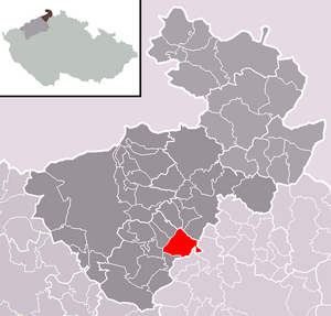
| Location of Velká Bukovina in the Děčín district | ||||

|
||||
Velká Bukovina (German Groß Bocken ) is a municipality in the Czech Republic . It is located 14 kilometers southeast of Děčín and belongs to the Okres Děčín .
geography
Geographical location
The Waldhufendorf extends in the north of the Bohemian Central Uplands along the Bukovinský creek ( Bockenbach ). The Rozmezí (420 m) rises to the northeast, the Špičák (412 m) to the east, the Dvorský Kopec ( Höfelberg , 537 m) to the south-east of the Dubový vrch (402 m), to the west of the Kotel ( Fuchsberg , 395 m) and im Northwest of the Bukovinský vrch ( Bockenberg , 444 m).
Community structure
The municipality of Velká Bukovina consists of the districts Karlovka ( Karlsthal ), Malá Bukovina ( Klein Bocken ) and Velká Bukovina ( Groß Bocken ), which also form cadastral districts. The Skřivánčí ( Lerchenthal ) desert also belongs to Velká Bukovina .
Neighboring communities
Neighboring towns are Malá Bukovina and Karlovka in the north, Nový Oldřichov and Mistrovice in the northeast, Nová Ves and Volfartice in the east, Radeč in the southeast, Slunce, Dolní Police, Malý Šachov and Žandov in the south, Starý Šachov in the southwest, Františkov nad Ploučnicí in the west as well Benešov nad Ploučnicí and Dolní Habartice in the north-west.
history
The first mention of Bockven was in 1385. In 1454 the village belonged to the property of Johann von Wartenberg , who had acquired the goods in 1428 from Heinrich Berka von Dubá auf Wildenstein. The village belonged to the Sandauer estates, which were pledged to Přibík and Peter Thein zu Thein in 1538. The village was parish until the Thirty Years War to the parish of St. Bartholomäus in Sandau and then until 1658 to the parish in Oberpolitz . In 1633 Albrecht von Waldstein's troops marched through the village. In the berní rula of 1654, 17 farmers, twelve gardeners and 32 cottagers are recorded for Groß Bocken. There is evidence of a local judge since 1665. In 1722 the village was changed to the new parish of St. Wenceslas in Kleon Bocken. In 1732 Anna Maria Luisa de 'Medici acquired the estate and the festivals in Groß Bocken and connected this to the rule of Oberpolitz . Later the village became part of the Reichstadt rule . Karlsthal was created in 1792 when the Meierhof Oberhof was acquired . Until the middle of the 19th century, the residents lived mainly from agriculture. In Schaller's Moravian Topography, Groß Bocken is described with 156 houses and 1,046 inhabitants. In 1848 there were 1145 people in Groß Bocken, the highest population the town has ever reached.
After the abolition of patrimonial , Groß Bocken formed from 1850 with the districts Alt Schokau and Karlsthal a political municipality in the district administration Tetschen / Děčín. Alt Schokau broke away in 1877, and from 1914 Karlsthal also formed its own community. In 1899 the community had 1,077 inhabitants. In 1930 there were only 874. After the Munich Agreement , the municipality was added to the German Reich in 1938 and belonged to the Tetschen district until 1945 , and from 1943 Tetschen-Bodenbach . In 1939 there were 782 people in Groß Bocken, almost all of whom belonged to the German ethnic group. In 1945 Velká Bukovina returned to Czechoslovakia and the German residents were expelled . In 1949 Karlovka was incorporated, and in 1976 Malá Bukovina was added. Between 1980 and 1990 Velká Bukovina was a district of Benešov nad Ploučnicí .
Culture and sights
- Church of St. Wenceslas in Malá Bukovina

