
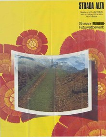
Strada Alta
The Strada Alta ( German Höhenweg) is a panoramic hiking route in the Leventina Valley in the canton of Ticino in Switzerland , largely on the former connecting route between the villages - even if only partially with old path elements.
Section Trans Swiss Trail
It is the counterpart on the one hand to the Strada Bassa down through the valley of the Leventina and on the other hand the even higher Sentiero dei Monti (between the Maiensässen and Alps from Lurengo to Someo) and the even higher summit trails (unofficially called Strada Veramente Alta ).
The Strada Alta is 45 kilometers long. Normally, the route is not covered in a single day, but either part of the route or the hike takes more than a day (there are officially three daily routes). The entire route is part of the national Trans Swiss Trail , which runs in 32 stages from Porrentruy in the canton of Jura to Mendrisio near the Italian border.
Route
The Strada Alta stretches over the left slope of the Leventina from Airolo to Biasca and leads hikers past little-known villages that lie on the sunny terraces of the valley. Most of these villages have become heavily depopulated in the course of the last century but still retain much of their old alpine character.
The hiking trail leads through practically every municipality that is on the left slope of the Leventina. Shortly after Airolo ( 1160 m above sea level ) the Strada Alta leaves the bottom of the valley, at Madrano at the entrance of the Val Canaria the path climbs away from the through road to Brugnasco and reaches the village of Altanca on the again via a short historical section through a mountain forest Area of the municipality of Quinto . Shortly before Altanca you can take the Ritom funicular to reach either Piotta on the valley floor or Lake Ritom in the Pioratal . The Strada Alta continues through mountain meadows via Cresta di Sopra , at 1,421 m above sea level. M. the highest point of the route, to the mountain villages Ronco (Quinto) (again with a short historical section in between that can only be walked on), Deggio , San Martino and Lurengo (from San Martino you can also reach Catto ). At Catto or Lurengo, the Strada Alta leaves the municipality of Quinto and thus also the Alta Leventina.
Descending through a spruce forest high above the Piottino Gorge , you reach Freggio , Brusgnano and finally Osco . An alternative route also reaches the hamlet of Vigera . From Osco it is possible to reach Faido on the valley floor by public transport . After Osco, the path leads again only as a footpath through forests and rough meadows to Calpiogna , Rossura and Tengia to arrive at the end in Calonico . From Osco to Calonico, hikers can enjoy the view of the entire Media Leventina .

After leaving Calonico, the Strada Alta leads through the so-called Traversa (this is how the municipalities of Calonico, Anzonico , Cavagnago and Sobrio are called). Here the view of the Bassa Leventina opens up . After Sobrio, the path begins to descend towards the bottom of the valley and, after crossing the Maiensäss in the municipal areas of Bodio and Pollegio, reaches the village of Biasca ( 301 m ).
Attractions
The Strada Alta has many special features. Various mountain villages with their monuments (especially churches, chapels, well-preserved historic village centers with old stone and wooden houses in the Walser style) can be visited, some of which are witnesses of an old and increasingly disappearing alpine culture. The view of the surrounding mountain landscape, which gradually changes the closer you get to Biasca, is interesting from a naturalistic point. The tourism associated with the Strada Alta is, along with mountain agriculture, one of the few resources in these mountain communities, some of which seem almost completely deserted and deserted over the winter months.
On the high path from Airolo to Biasca, hikers will often find small, simple restaurants that welcome hikers and offer them local dishes.
Due to the relatively good connection of these mountain villages to the valley via postbus courses, the whole stage can be divided individually according to needs. These also allow you to climb or descend from Faido via Molare to Carì to or from the higher-lying Sentiero dei Monti path , which is narrow and exposed in places and only suitable for good mountaineers.
Pop singer Nella Martinetti dedicated a song to the Strada Alta.
Web links
- Homepage of the Strada Alta
- Leventinatourismo - Strada Alta (PDF; 938 kB)
- Swiss hiking trails - Trans Swiss trail stage 25 Airolo-Osco, with links to the other stages
- Strada Alta Leventina - detailed route description on wandersite.ch