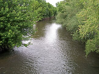
Straight River (Cannon River)
|
Straight River Owatonna |
||
|
The Straight River at Owatonna (2007) |
||
| Data | ||
| Water code | US : 652708 | |
| location | Minnesota , United States | |
| River system | Mississippi River | |
| Drain over | Cannon River → Mississippi River → Gulf of Mexico | |
| source |
Geneva Township , Freeborn County 43 ° 49 ′ 58 " N , 93 ° 15 ′ 46" W |
|
| Source height | 370 m | |
| muzzle |
Cannon River , Faribault Township , Rice County Coordinates: 44 ° 18 ′ 36 " N , 93 ° 16 ′ 13" W, 44 ° 18 ′ 36 " N , 93 ° 16 ′ 13" W |
|
| Mouth height | 292 m | |
| Height difference | 78 m | |
| Bottom slope | 1.1 ‰ | |
| length | 73 km | |
| Catchment area | 1165 km² | |
| Drain |
MQ |
8 m³ / s |
The Straight River is a 73 km long tributary of the Cannon River in the southeast of the US state Minnesota . About the Cannon River it is part of the catchment area of the Mississippi River and drains an area with an area of 1165 km² in an agricultural region.
The name is a translation of Owatonna , the name of the river in the Sioux languages and means straight river in German . Despite its name to the contrary, the river is winding, although its valley is almost straight. During the 19th century the river was used to drive flour mills .
geography
The origin of the Straight River is assumed north of Geneva in Geneva Township in the north of Freeborn County , although the headwaters were changed by the creation of drainage ditches. The Straight River flows north through Steele County to the south of Rice County , past the towns of Owatonna and Medford , to its confluence with the Cannon River at Faribault .
The Minnesota Department of Natural Resources has classified the Straight River as a route for canoeing . It generally flows through farmland and its narrow river bed is forested, mostly with elm , willow , poplar and maple . There are occasional flat spots along its course and there are rapids in Clinton Falls Township in northern Steele County . Fish species in the Straight River are pike , sunfish , smallmouth bass and carp .
The main tributaries of the Straight River include the Turtle Creek , the Maple Creek , which flows into Owatonna, the Crane Creek , which rises in Waseca , which flows north of Owatonna into the Straight River, and the Medford Creek .
Flow rate
The United States Geological Survey operates a gauge above Faribault . Here the flow rate averaged 8 m³ / s between 1966 and 2005. The highest value was 172 m³ / s on June 12, 2004, the lowest value was observed on October 27, 1976 with about 0.3 m³ / s.
See also
Individual evidence
- ^ A b Straight River (Cannon River) ( English ) In: Geographic Names Information System . United States Geological Survey . Retrieved February 16, 2011.
- ^ Warren Upham: Minnesota Place Names: A Geographical Encyclopedia. . Minnesota Historical Society . S. Steele County . Archived from the original on June 20, 2007. Info: The archive link was inserted automatically and has not yet been checked. Please check the original and archive link according to the instructions and then remove this notice. Retrieved June 24, 2007.
- ^ A b Minnesota Department of Natural Resources Canoeing: Straight River . Minnesota Department of Natural Resources . 2007. Archived from the original on July 1, 2007. Info: The archive link was automatically inserted and not yet checked. Please check the original and archive link according to the instructions and then remove this notice. Retrieved June 17, 2007.
- ^ A b Minnesota Atlas & Gazetteer . DeLorme , Yarmouth, Me. 1994, ISBN 0-89933-222-6 , pp. 24, 33.
- ^ GB Mitton, KG Guttormson, GW Stratton, ES Wakeman: Water Resources Data in Minnesota, Water Year 2005 Annual Report. . United States Geological Survey . S. Straight River near Park Rapids, MN . Retrieved June 24, 2007 (PDF file; 135 kB)
