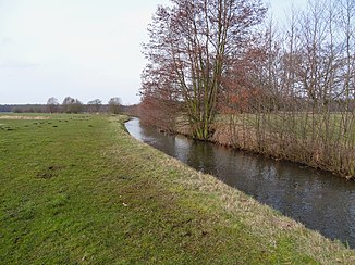
Tarnitz
| Tarnitz | ||
| Data | ||
| Water code | DE : 59322 | |
| location | Mecklenburg-Western Pomerania , Brandenburg | |
| River system | Elbe | |
| Drain over | Löcknitz → Elbe → North Sea | |
| source | Between Muchow and Stolpe 53 ° 19 ′ 53 ″ N , 11 ° 42 ′ 29 ″ E |
|
| Source height | approx. 42 m above sea level NHN | |
| muzzle | at Streesow in the Löcknitz coordinates: 53 ° 13 '10 " N , 11 ° 43' 39" E 53 ° 13 '10 " N , 11 ° 43' 39" E |
|
| Mouth height | 26.2 m above sea level NHN | |
| Height difference | approx. 15.8 m | |
| Bottom slope | approx. 1.1 ‰ | |
| length | 14 km | |
| Right tributaries | Meynbach | |
The Tarnitz is a right tributary of the Löcknitz in the southwest of Mecklenburg-Western Pomerania and in the north of Brandenburg .
The approximately 14-kilometer-long river course has its origin in a small forest area on the municipal boundary between Muchow and Stolpe at an altitude of about 42 meters above sea level. From here the Tarnitz flows first about a kilometer in a south-westerly direction and then in a southerly direction, eastwards past the places Muchow and Zierzow . In the municipality of Prislich , meadows and larger forest areas border on the right bank, otherwise arable areas are passed through almost exclusively, from which numerous drainage ditches lead water into the Tarnitz. The Meynbach flows into the west at the border between Mecklenburg-Western Pomerania and Brandenburg . From here on, the Tarnitz runs in a south-easterly direction to the Brandenburg area, then forms the state border on a small section and flows into the Löcknitz here at Streesow. In its course, the river overcomes a difference in altitude of about 16 meters.
The expert state program of Mecklenburg-Western Pomerania from 2003 describes the almost continuously straightened course of the Tarnitz river as "remote from nature".
