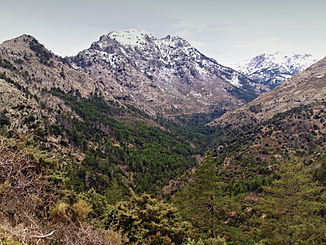
Tartagine
| Tartagine | ||
|
The headwaters of the Tartagine |
||
| Data | ||
| Water code | FR : Y7110500 | |
| location | France , Corsica | |
| River system | Golo | |
| Drain over | Asco → Golo → Mediterranean | |
| source | in the municipality of Olmi-Cappella 42 ° 27 ′ 37 ″ N , 8 ° 55 ′ 34 ″ E |
|
| Source height | approx. 1865 m | |
| muzzle | on the municipal boundary of Piedigriggio and Canavaggia in the Asco coordinates: 42 ° 29 ′ 0 ″ N , 9 ° 11 ′ 30 ″ E 42 ° 29 ′ 0 ″ N , 9 ° 11 ′ 30 ″ E |
|
| Mouth height | approx. 200 m | |
| Height difference | approx. 1665 m | |
| Bottom slope | approx. 56 ‰ | |
| length | 30 km | |
| Left tributaries | Melaja | |
The Tartagine is a river in France that runs in the Haute-Corse department on the island of Corsica . It rises on the eastern flank of Monte Corona (2144 m) in the Forêt Territoriale de Tartagine of the same name , drains in an arc from northeast to east to southeast through the Corsica Regional Nature Park and flows after 30 kilometers at the hamlet of Pontare , on the municipal boundary of Piedigriggio and Canavaggia , as a left tributary into a branch of the Asco . At its mouth, the valley of the Tartagine is used by the national road 1197 as well as by the railway line from Calvi to Ajaccio .
Places on the river
- Old Tartagine-Melaja forester's lodge (now a refuge), Mausoléo municipality
- Piana , Castifao Municipality
Web links
Commons : Tartagine - collection of images, videos and audio files
Remarks
- ↑ Source geoportail.fr (1: 32,000)
- ↑ estuary geoportail.fr (1: 16,000)
- ↑ a b The information on the length of the river is based on the information on the Tartagine from SANDRE (French), accessed on April 1, 2012, rounded to the nearest kilometer.
