
Tbong Khmum
| ខេត្ត ត្បូងឃ្មុំ Tbong Khmum
|
|
|---|---|
  |
|
| Basic data | |
| Country | Cambodia |
| Capital | Suong |
| surface | 4928 km² |
| Residents | 810,000 (2017) |
| density | 164 inhabitants per km² |
| ISO 3166-2 | KH-25 |
Coordinates: 12 ° 0 ' N , 105 ° 50' E
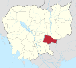
Tbong Khmum ( Khmer ខេត្ត ត្បូងឃ្មុំ , IPA : [ tɓouŋ kʰmum ]) is a province in eastern Cambodia between the Mekong and the border with Vietnam .
The capital is called Suong .
administration
The province is divided into the following six districts and the city of Suong:
| Geocode | Khmer | District names |
|---|---|---|
| 0301 | ដំបែ | Dambae |
| 0302 | ក្រូចឆ្មារ | Krouch Chhma |
| 0303 | មេមត់ | Memot |
| 0304 | អូរាំង ឪ | Ou Reang Ov |
| 0305 | ព ញ្ញា ក្រែក | Ponhea Kraek |
| 0306 | ត្បូងឃ្មុំ | Tboung Khmum |
| 0307 | ក្រុង សួង | Krong Suong |
statistics
Tbong Khmum covers an area of 4,928 km² and has 810,000 inhabitants.
history
The province was created by a decree of King Norodom Sihamoni of December 31, 2013 from the eastern six districts and a commune of the Kampong Cham province .
Individual evidence
- ↑ Statistically projected population figures for 2017 on citipopulation.de
- ↑ Cambodia: Provinces, Cities, Urban Communities & Agglomerations - Population Statistics in Maps and Tables. Retrieved May 7, 2018 .
- ↑ Mom Kunthear and Kevin Ponniah: Kampong Cham's great divide in: The Phnom Penh Post, January 10, 2014, accessed January 14, 2014
Provinces:
Banteay Meanchey |
Battambang |
Kampong Cham |
Kampong Chhnang |
Kampong Speu |
Kampong Thom |
Kampot |
Kandal |
Kep |
Koh Kong |
Kratie |
Mondulkiri |
Oddar Meanchey |
Pailin |
Preah Vihear |
Prey Veng |
Pursat |
Ratanakiri |
Siem Reap |
Sihanoukville |
Stung Treng |
Svay Rieng |
Takeo |
Tbong Khmum
City with provincial status:
Phnom Penh