The Pinnacles (Dorset)
| The Pinnacles | ||
 The Pinnacles , Isle of Purbeck |
||
| Geographical location | ||
|
|
||
| Coordinates | 50 ° 38 '14 " N , 1 ° 55' 38" W | |
| Waters 1 | English Channel | |
The The Pinnacles are two pinnacles , surf pillars , on the peninsula Isle of Purbeck on the coast of the county of Dorset on the south coast of England .
location
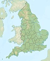
The chalk pillars , The Pinnacles, stand below the Ballard Point cliffs, between Studland Bay and Swanage Bay. The Pinnacles are 2 kilometers directly east of Studland, a few hundred meters south of Handfast Point and Old Harry Rock, and about five kilometers northeast of Swanage.
nature
The sea once washed a large hole in the rock through erosion from the surf . The resulting cavern , called Parson's Barn , was used as a smuggler's hideout. Much of it has collapsed since then and was eroded by the sea, only a few rock needles remained.
The coast and cliffs along East Devon and Dorset on the English Channel are some of the natural wonders of the world. From Orcombe Point near Exmouth to the Old Harry Rocks near Studland Bay , there is a 155-kilometer stretch of coastline, which was the first natural landscape in England to be declared a UNESCO World Heritage Site. The remains of Parson's Barn and The Pinnacles are part of the so-called Jurassic Coast .
See also
Individual evidence
- ^ Dorset and East Devon Coast . UNESCO World Heritage Center. 2001. Retrieved November 16, 2011.

