Trézence
| Trézence | ||
|
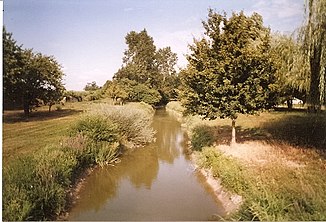
The river at Migré |
||
| Data | ||
| Water code | FR : R61-0430 | |
| location | France , Nouvelle-Aquitaine region | |
| River system | Charente | |
| Drain over | Boutonne → Charente → Atlantic Ocean | |
| source | in the parish of Loulay 46 ° 2 ′ 18 ″ N , 0 ° 30 ′ 40 ″ W |
|
| Source height | approx. 79 m | |
| muzzle | on the municipal boundary of Tonnay-Boutonne and Torxé in the Boutonne Coordinates: 45 ° 57 ′ 34 ″ N , 0 ° 41 ′ 32 ″ W 45 ° 57 ′ 34 ″ N , 0 ° 41 ′ 32 ″ W |
|
| Mouth height | approx. 4 m | |
| Height difference | approx. 75 m | |
| Bottom slope | approx. 2.7 ‰ | |
| length | 28 km | |
The Trézence is a river in France that runs in the Charente-Maritime department in the Nouvelle-Aquitaine region . It rises just south of Loulay , drains in the upper reaches north and north-west, but then swings to the south-west and flows after 28 kilometers at the municipal boundary of Tonnay-Boutonne and Torxé as a right tributary into the Boutonne . In its lower reaches, it crosses several wetlands and has developed into the Canal de Sainte-Julienne drainage canal .
Places on the river
(in flow order)
- Loulay
- Migré
- Tournay , municipality of Puyrolland
Individual evidence
- ↑ Source geoportail.gouv.fr
- ↑ estuary geoportail.gouv.fr
- ↑ a b The information on the length of the river is based on the information about the Trézence at SANDRE (French), accessed on May 1, 2013, rounded to full kilometers.
