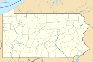
Turbotville
| Turbotville | ||
|---|---|---|
 Pennsylvania Route 44 in Turbotville |
||
| Location in Pennsylvania | ||
|
|
||
| Basic data | ||
| Foundation : | 1850 (settled) 1858 (incorporated) |
|
| State : | United States | |
| State : | Pennsylvania | |
| County : | Northumberland County | |
| Coordinates : | 41 ° 6 ′ N , 76 ° 46 ′ W | |
| Time zone : | Eastern ( UTC − 5 / −4 ) | |
| Residents : | 691 (as of: 2000) | |
| Population density : | 575.8 inhabitants per km 2 | |
| Area : | 1.2 km 2 (approx. 0 mi 2 ) of which 1.2 km 2 (approx. 0 mi 2 ) are land |
|
| Height : | 178 m | |
| Postal code : | 17772 | |
| Area code : | +1 570 | |
| FIPS : | 42-77832 | |
| GNIS ID : | 1189931 | |
| Mayor : | Lester Miller | |
 church |
||
Turbotville is a borough in Northumberland County in Pennsylvania , United States . In 2000 Turbotville had 691 residents.
geography
Turbotville's geographic coordinates are 41 ° 6 ' N , 76 ° 46' W (41.102454, -76.771188). According to the United States Census Bureau , the borough has an area of 1.2 km 2 , without any significant body of water.
Turbotville is located in the Upper Susquehanna Valley in north-central Pennsylvania. Turbotville is the northernmost city in Northumberland County and is entirely within the Lewis Township. The city limits are completely irregular in shape; the town's road network is aligned with Main Street ( Pennsylvania Route 44 ), which runs southwest to northeast through the town. This meets Pennsylvania Route 54 in the north of the borough and runs together with it to the east. There is also a railway line from Conrail through Turbotville.
Demographics
| Population development | |||
|---|---|---|---|
| Census | Residents | ± in% | |
| 1860 | 380 | - | |
| 1870 | 417 | 9.7% | |
| 1880 | 414 | -0.7% | |
| 1890 | 441 | 6.5% | |
| 1900 | 390 | -11.6% | |
| 1910 | 365 | -6.4% | |
| 1920 | 415 | 13.7% | |
| 1930 | 456 | 9.9% | |
| 1940 | 523 | 14.7% | |
| 1950 | 518 | -1 % | |
| 1960 | 612 | 18.1% | |
| 1970 | 627 | 2.5% | |
| 1980 | 675 | 7.7% | |
| 1990 | 675 | 0% | |
| 2000 | 691 | 2.4% | |
| 2010 | 705 | 2% | |
| 2015 estimate | 687 | -2.6% | |
| Sources: | |||
At the time of the United States Census 2000, Turbotville was inhabited by 691 people. The population density was 592.9 people per km 2 . There were 302 housing units, an average of 259.1 per km 2 . The population in Turbotville was 99.13% White , 0.14% Black or African American , 0.14% Native American , 0% Asian , 0% Pacific Islander , 0% said they were racial , and 0.58 % named two or more races. 0% of the population declared to be Hispanic or Latinos of any race.
The residents of Turbotville were distributed among 278 households out of which 37.8% were living in children under 18 years of age. 57.2% of households were married, 9.4% had a female head of household without a husband, and 31.3% were not families. 27.7% of households were made up of individuals and someone lived in 9.7% of all households aged 65 years or older. The average household size was 2.49 and the average family size was 3.03.
The population was divided into 28.2% minors, 7.2% 18–24 year olds, 31.5% 25–44 year olds, 21.1% 45–64 year olds and 11.9% aged 65 and over or more. The median age was 34 years. For every 100 women there were 91.9 men. For every 100 women over 18, there were 83.7 men.
The median household income in Turbotville was 40,221 US dollars and the median family income reached the amount of 43,750 US dollars. The median income for men was $ 35,875 compared with $ 25,583 for women. The per capita income was $ 18,401. 3.8% of the population and 4.5% of families had an income below the poverty line , including 1.6% of minors and 13.5% of those aged 65 and over.
park
Turbotville Community Park is at the intersection of Church and Pine Streets. The park has tennis courts, a playground and a picnic pavilion.
education
Turbotville is part of the Warrior Run School District, which includes Watsontown, Dewart, McEwensville, Exchange, Lewis Township, Delaware Township, a small portion of Gregg Township in Union County, and other non-community areas. There is an elementary school in the community. Originally the high school was a timber frame building on Church Street, which was replaced in 1937 by a new brick building on Pine Street due to high heating costs. It became an elementary school in 1958 when a new high school was built on the Susquehanna Trail outside Turbotville.
Web links
supporting documents
- ↑ Annual Estimates of the Resident Population for Incorporated Places: April 1, 2010 to July 1, 2015 ( English ) Retrieved July 2, 2016.
- ^ Census of Population and Housing ( English ) US Census Bureau. Retrieved December 11, 2013.
- ↑ American FactFinder ( English ) United States Census Bureau . Retrieved January 31, 2008.
- ↑ Incorporated Places and Minor Civil Divisions Datasets: Subcounty Resident Population Estimates: April 1, 2010 to July 1, 2012 ( English ) In: Population Estimates . US Census Bureau. Retrieved December 11, 2013.
