
Pennsylvania Route 44

|
|
|---|---|
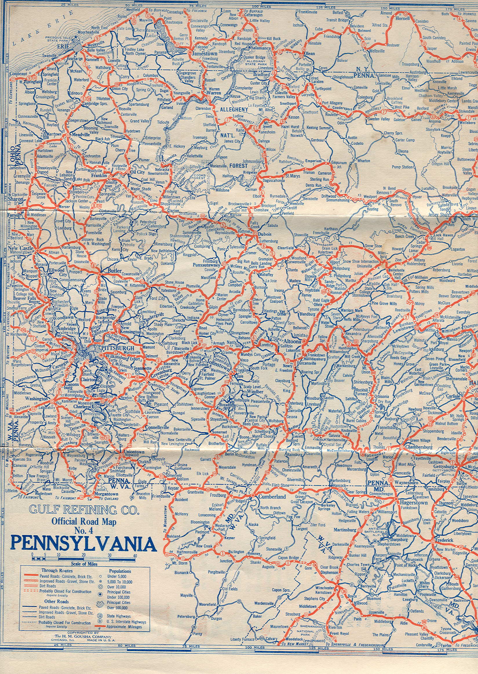
| map | |

|
|
| Basic data | |
| Overall length: | 149.24 m / 240.21 km |
| Opening: | 1927 |
| Starting point: |
|
| End point: | near NY 417 in Ceres Township |
| Counties: |
Columbia County Montour County Northumberland County Union County Lycoming County Clinton County Potter County McKean County |
Pennsylvania Route 44 ( PA 44 ) is a 150 miles long state route in the US state of Pennsylvania . The route runs from the intersection with Interstate 80 and Pennsylvania Route 42 in Buckhorn to the Pennsylvania- New York border near New York State Route 417 in Ceres Township .
PA 44, commissioned by the Pennsylvania Department of Highways in 1927 , originally ran from the New York state line to Jersey Shore . Today the route runs as a scenic road from Union County to Potter County .
Route description
Columbia County and Montour County
PA 44 begins in the hamlet of Buckhorn, at the junction with Pennsylvania Route 42 at Exit 232 of Interstate 80 . From there the highway runs as Buckhorn Road to the northeast through the Appalachians . In Jerseytown, the route intersects Pennsylvania Route 642 and Pennsylvania Route 254 . Outside of town, PA 44 turns west as White Hall Road.
The route runs through the Muncy Hills and reaches Montour County . From Schuyler to Turbotville , Route 44 competes with Pennsylvania Route 54 as Continental Boulevard.
Northumberland County and Union County
PA 44 enters Northumberland County and runs in a southwestern direction through the largely flat and agricultural area of the county. In the village of Mcewensville, just east of the Interstate 180 underpass , Route 44 crosses Main Street, the historic Susquehanna Trail, and what was once US Highway 111 . From Watsontown to Dewart, the route joins Pennsylvania Route 405 . At Dewart, PA 44 turns west and crosses the West Branch Susquehanna River as Bridge Avenue.
West of the bridge, PA 44 is designated a scenic route up to the junction with Pennsylvania Route 144 in Potter County. After the bridge, the route crosses US Highway 15 in the Union County community of Allenwood . To the west of the hamlet, PA 44 runs largely on the banks of White Deer Hole Creek in the White Deer Valley to the west.
Clinton County and Lycoming County

The highway reaches Lycoming County in the White Deer Valley. In the hamlet of Washington, at the junction with Gap Road, PA 44 turns north before reaching the southern terminus of Pennsylvania Route 554 at Elimsport; from this intersection the highway heads west.
To the west of the village the road crosses the North White Deer Ridge, one of the ridges that make up the Appalachian Mountains. West of the ridge, Pennsylvania Route 44 crosses in Collomsville Pennsylvania Route 654 at its southern end. PA 44 continues west to a breakthrough valley that cuts Bald Eagle Ridge near the junction with Pennsylvania Route 880 , from where the highway heads north.
North of this breakthrough valley, the route resumes its westerly direction and again crosses the West Branch Susquehanna River and reaches Jersey Shore. Within the borough , PA 44 runs a short distance as Main Street northwards to US Highway 220 , with which it then has a common but opposite route for about five kilometers.
US 220 is developed here as a motorway and bears the official name Frank D. Oreilly Highway . Southwest of the Pine Creek crossing , these two routes separate. PA 44 crosses the stream again and continues north on its western bank.
In the village of Tomb, PA 44 intersects the western terminus of Pennsylvania Route 973 and the highway passes through Pine Creek Gorge . Near Cummings, the route turns west and intersects Pennsylvania Route 414 . The highway continues through the southern part of the Tiadaghton State Forest . The remainder of the route through Lycoming County Route 44 runs north and forms the border between Lycoming County and Clinton County .
Potter County and McKean County
PA 44 passes through the western part of the Tioga State Forest in the Potter County . At the eastern tip of the Susquehannock State Forest , a common stretch of road begins with Pennsylvania Route 144 ; the road marked as picturesque then leads south on Route 144. After a short walk together on Pine Hill Road, PA 44 takes a north-westerly direction and leads through a more mountainous landscape. This section of the route is named Cherry Springs Road and passes many hills and mountains, including Mount Brodhead, Cherry Springs Vista, Kaple Hill, and Cochran Hill.
North of this mountainous area, PA 44 turns west and runs in competition with US Highway 6 as the Grand Army of the Republic Highway to Coudersport , where the two roads separate; US 6 heads south and PA 44 north on Main Street. Outside of Coudersport, PA 44 meets the west end of Pennsylvania Route 49 .
The route continues north into the Greenman Hill area. In Coneville, PA 44 crosses the western terminus of Pennsylvania Route 244 . From there the highway heads northwest. It runs for about three miles through McKean County before ending at the state border with New York. In New York, the road leads to New York State Route 417, which is just one kilometer away .
history

When Pennsylvania Route 44 went into service in 1927, the route ran from US Highway 220 in Jersey Shore to the New York-Pennsylvania border. Northeast of Coudersport between Pennsylvania Route 49 and Pennsylvania Route 244 and from US 6 to US 220, the road was unpaved. PA 44 was designated Pennsylvania Route 54 between Jersey Shore and Turbotville. Between Turbotville and Jerseytown, the road was Pennsylvania Route 454 . Between Jerseytown and Buckhorn, today's Route 44 was numbered as Pennsylvania Route 342 .
In 1940, PA 44 was extended eastwards to Turbotville, replacing the earlier PA 54. In the course of the 1940s, the route from Coudersport to the state border in New York was completely paved. In the 1950s, Route 44 was extended to Mahanoy City in Schuylkill County .
In 1970 the route was reduced to its current course with the southern end point in Buckhorn.
Intersections
| county | location | mile | crossed road | Remarks |
|---|---|---|---|---|
| Columbia | Buckhorn | 0.00 |
|
Exit 232 (I-80) |
| Madison Township | 6.75 |
|
east end of PA 642 | |
| 7.83 |
|
|||
| Montour | Anthony Township | 16.11 |
|
southern end point of the overlap |
| Northumberland | Turbotville | 18.61 |
|
northern end point of the overlap |
| McEwensville | 22.75 | Susquehanna Trail | former US 111 | |
| Watsontown | 24.64 |
|
southern end point of the overlap | |
| Delaware Township | 26.92 |
|
northern end point of the overlap | |
| union | Allenwood | 27.90 |
|
|
| Lycoming | Washington Township | 35.44 |
|
southern end point of PA 554 |
| Limestone Township | 43.12 |
|
western end point of PA 654 | |
| 47.03 |
|
northern end point of PA 880 | ||
| Piatt Township | 51.49 |
|
Junction, southern end point of the overlap | |
| Clinton | Pine Creek Township | 54.16 |
|
Junction, northern end point of the overlap |
| Lycoming | Watson Township | 59.22 |
|
western end point of PA 973 |
| Cummings Township | 66.72 |
|
Waterville, western terminus of PA 414 | |
| Gallagher Township | 72.04 |
|
northern end point of PA 664 | |
| Potter | Stewardson Township | 96.26 |
|
southern end point of the overlap |
| Abbott Township | 101.59 |
|
northern end point of the overlap | |
| Sweden Township | 120.31 |
|
southern end point of the overlap | |
| Coudersport | 122.44 |
|
northern end point of PA 872 | |
| 124.40 |
|
northern end point of the overlap | ||
| Eulalia Township | 127.45 |
|
western end point of PA 49 | |
| Hebron Township | 136.07 |
|
western end point of PA 244 | |
| McKean | State border with New York | 149.24 |
|
|
| 1,000 mi = 1.609 km; 1,000 km = 0.621 mi | ||||
supporting documents
- ^ Gulf Oil (1926) (in English). Pennsylvania Highway Map (west side) . Retrieved July 19, 2011.
- ^ Pennsylvania Department of Highways (1927) (in English). Pennsylvania Highway Map . Retrieved July 19, 2011.
- ↑ Google Maps . overview map of Pennsylvania Route 44; includes topographic view of the route . Retrieved July 19, 2011.
- ^ Rand McNally & Company (2007). Motor Carrier's Road Atlas [map], Deluxe. P. 86, 88, grid square WE12, EH2, EI4, EJ6. ISBN 0-528-90075-7 .
- ^ Pennsylvania Department of Highways (1929) (in English). Pennsylvania Road Map (middle section) . Archived from the original on (May 26, 2011). Retrieved July 19, 2011.
- ^ A b Pennsylvania Department of Highways (1930) (in English). Pennsylvania Road Map (front section) (PDF). Retrieved July 19, 2011.
- ^ Pennsylvania Department of Highways (1940) (in English). Pennsylvania Road Map (front section) (PDF). Retrieved July 19, 2011.
- ^ Pennsylvania Department of Highways (1950) (in English). Pennsylvania Road Map (front section) (PDF). Retrieved July 19, 2011.
- ^ Pennsylvania Department of Highways (1970) (in English). Pennsylvania Road Map (front section) (PDF). Retrieved July 19, 2011.