Ullswater
| Ullswater | ||
|---|---|---|

|
||
| Ullswater | ||
| Geographical location | Lake District , Cumbria , England | |
| Tributaries | Goldrill Beck , Glenridding Beck , Aira Beck , Sandwick Beck | |
| Drain | River Eamont | |
| Data | ||
| Coordinates | 54 ° 34 ′ N , 2 ° 54 ′ W | |
|
|
||
| length | 14.5 km | |
| width | 1.2 km | |
| Middle deep | 60 m | |
The Ullswater is the second largest lake in the English Lake District . It is approximately 14.5 kilometers long and 1200 meters wide, with an average depth of 60 meters.
description
Many consider the Ullswater to be the most beautiful of the English lakes and compare it to Lake Lucerne in Switzerland . The elongated "ribbon" -like shape of the lake is typical of the lakes of the Lake District. It was created by the glaciers of the last Ice Age , which hollowed out the valley floor. Due to the meltwater of the glaciers, the resulting cavity filled with water. Due to the surrounding mountains, the Ullswater takes on the shape of an elongated Z and is divided into three segments, the so-called reaches .
The origin of the name Ullswater is unknown. On the one hand, it is believed that the name is derived from a Nordic chief named Ulf, who ruled over this area. On the other hand, there was a Saxon Lord of Greystoke by the name of Ulphus, whose land extended to the lake.
The village of Glennridding is at the southern end of the lake. It serves as a starting point for hikes on England's third highest mountain, Helvellyn , and many other rewarding peaks. The village of Pooley Bridge is at the north end of the lake. Its narrow 16th century bridge over the Eamont , which flows out of the Ullswater, is overlooked by the Iron Age Fort Dunmallard Hill. For much of its length, the Ullswater forms a natural boundary between the traditional counties of Cumberland and Westmorland .
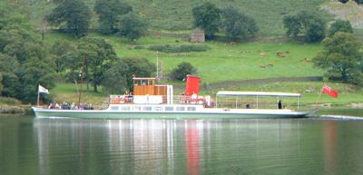
One of the lake's greatest attractions is the Lake Steamers, which operate excursions between Pooley Bridge, Glenridding and Howtown in the summer. These steamships are original post transport and passenger ships from the 1850s that supplied the Greenside lead mine, which ceased operations in 1962. Today there are three steamers sailing on the Ullswater: the "Raven", the "Lady of the Lake" and the "Lady Dorothy". In the summer it is very popular to take the ferry from Glennridding to Howtown and then return along the lakeshore on one of the Lake District's most popular and scenic hiking trails.
Sailing on the Ullswater is also very popular, and there are several marinas around the lake. There are also opportunities for rowing, water skiing and motor boating. Another Ullswater attraction is the Aira Force , a spectacular waterfall halfway on the west bank of the lake. Part of the Ullswater is within National Trust territory .
Sir Donald Campbell set a new world speed record on the water here on July 23, 1955 when he accelerated his turbine-powered "hydroplane" "Bluebird K7" to 325.53 km / h (202.32 mph).
Just south of Pooley Bridge is located on the east side of the lake Eusemere where the anti-slavery activist Thomas Clarkson ( 1760 - 1846 ) lived. From this house you have one of the best views over the lower "reach" of the Ullswater. William and Dorothy Wordsworth were friends of Clarkson and visited him on many occasions, which inspired Wordsworth to write his poem "Daffodils" (daffodils) in April 1802 after seeing them on the banks of the Ullswater. Wordsworth once wrote about the Ullswater: "it is the happiest combination of beauty and grandeur, which any of the lakes affords" (It is the happiest combination of beauty and splendor that any of the lakes offers).
See also
Web links
- Ullswater and Aira Force information at the National Trust
- Lake District Desktops - Ullswater information and photographs.


