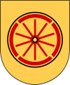
Vaggeryd (municipality)
| Vaggeryd municipality | |||||
|---|---|---|---|---|---|
|
|||||
| State : | Sweden | ||||
| Province (län): | Jönköpings län | ||||
| Historical Province (landskap): | Småland | ||||
| Main place: | Vaggeryd and Skillingaryd | ||||
| SCB code: | 0665 | ||||
| Residents : | 14,275 (December 31, 2019) | ||||
| Area : | 858.2 km² (January 1, 2016) | ||||
| Population density : | 16.6 inhabitants / km² | ||||
| Website : | www.vaggeryd.se | ||||
| List of municipalities in Sweden | |||||
Coordinates: 57 ° 30 ′ N , 14 ° 9 ′ O Vaggeryd is a municipality ( Swedish : kommun ) in the Swedish province of Jönköpings län and the historic province of Småland . The municipality has two main towns, Vaggeryd and Skillingaryd .
Other notable places are Åker, Bondstorp, Byarum, Hok and Klevshult. The community is about 30 kilometers south of Jönköping . The European route 4 and the Halmstad - Nässjö railway line run through the municipality .
geography
The municipality is located in the southern Swedish highlands and the municipality is mainly covered by forest. The forestry use is made more difficult by numerous wetlands. In the south of the municipality is the northern branch of the Store Mosse National Park .
economy
Vaggeryd is a strong industrial community. Above all, Skillingaryd and Vaggeryd are home to numerous industrial companies.
Web links
swell
- ↑ Folkmängd i riket, län och kommuner December 31, 2019 at Statistiska centralbyrån
- ↑ Kommunarealer January 1, 2016 at Statistiska centralbyrån (including all inland waters)

