Vaudelle
| Vaudelle | ||
|
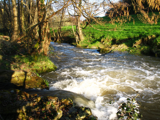
The river at Saint-Mars-du-Désert |
||
| Data | ||
| Water code | FR : M0124000 | |
| location | France , Pays de la Loire region | |
| River system | Loire | |
| Drain over | Sarthe → Maine → Loire → Atlantic Ocean | |
| source | near the hamlet of La Retardière in the municipality of Izé 48 ° 13 ′ 9 ″ N , 0 ° 20 ′ 0 ″ W |
|
| Source height | approx. 295 m | |
| muzzle | in the municipality of Saint-Georges-le-Gaultier in the Sarthe Coordinates: 48 ° 18 ′ 13 ″ N , 0 ° 4 ′ 13 ″ W 48 ° 18 ′ 13 ″ N , 0 ° 4 ′ 13 ″ W |
|
| Mouth height | approx. 84 m | |
| Height difference | approx. 211 m | |
| Bottom slope | approx. 7 ‰ | |
| length | 30 km | |
| Catchment area | approx. 93 km² | |
The Vaudelle is a river in France that runs in the Pays de la Loire region . It rises from a small reservoir near the hamlet of La Retardière in the municipality of Izé , drains generally from northeast to east, crosses the southern section of the Normandy-Maine Regional Nature Park in its lower reaches and flows into the municipality of Saint-Georges-le-Gaultier after a total of 30 kilometers as a right tributary into the Sarthe . On its way, the Vaudelle touches the departments of Mayenne and Sarthe .
Places on the river
(Order in flow direction)
- La Retardière , municipality of Izé
- Izé
- Saint-Thomas-de-Courceriers
- Saint-Mars-du-Désert
- Saint-Georges-le-Gaultier
Attractions
- Château de Courceriers, castle from the 16th and 17th centuries on the river bank near Saint-Thomas-de-Courceriers - Monument historique
- Manoir de Classé, 15th and 16th century mansion on the banks of the river in the municipality of Saint-Germain-de-Coulamer - Monument historique
Individual evidence
- ↑ Source geoportail.gouv.fr
- ↑ estuary geoportail.gouv.fr
- ↑ a b Water information system Service d'Administration National des Données et Référentiels sur l'Eau (French) ( information ), accessed on December 1, 2016, rounded to full kilometers
- ↑ Château de Courceriers in the Base Mérimée of the French Ministry of Culture (French)
- ↑ Manoir de Classé in the Base Mérimée of the French Ministry of Culture (French)
