Veerse Meer
| Veerse Meer | |
|---|---|

|
|
| Veerse Meer near Wolphaartsdijk | |
| Geographical location | Zeeland Province , Netherlands |
| Islands | North Beveland |
| Places on the shore | Kamperland , Kortgene , Veere , Wolphaartsdijk |
| Data | |
| Coordinates | 51 ° 31 ' N , 3 ° 42' E |
| Altitude above sea level |
0.0 m (summer) -0.3 m (winter) |
| surface | 20.3 km² |
| length | 22 km |
| width | 0.15 km - 1.5 km |
| scope | 55 km |
| Maximum depth | 17.3 m |
|
particularities |
Originated from the construction of the Veerse Gatdams |
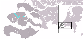
The Veerse Meer (also called Veerse Gat ) is an inland waterway that was created by the Veerse Gatdam in 1961 as part of the Delta Plan . The Veerse Meer is the northeastern boundary of the Walcheren peninsula . In addition, the Veerse Meer separates the Zuid-Beveland peninsula and today's Noord-Beveland peninsula .
Before 1961 the Veerse Meer had a direct connection to the North Sea. Due to the construction of the Veerse Gatdam and Zandkreekdam in the east, the salinity of the water decreased sharply and the Gat became brackish , with all negative effects for life in and around the water. After interventions by citizens' groups and mussel fishermen, salt water has been discharged from the Oosterschelde since May 2004 . For this purpose, a controllable passage ( sluice ) was created in the Zandkreekdam. When the water level is high ( high tide ) in the Oosterschelde, oxygen-rich and salty North Sea water flows into the Veersemeer, and when the tide is low ( ebb ), nutritional water flows back from the Veersemeer. As a result, the salt content in the gat has increased again and the water quality has improved.
In the Veerse Meer there are thirteen smaller, uninhabited islands and sandbanks. Today the inland water is particularly popular with windsurfers and sailors . The eponymous town of Veere is located on the Veerse Meer and is very popular with both water sports enthusiasts and day-trippers. Here the canal flows through Walcheren into the Veerse Meer. Other well-known holiday resorts are Vrouwenpolder , located directly on the western ramp of the Veerse Gatdams, Wolpaartsdijk in the west on Zuid-Beveland near the Zandkreekdam, and on the opposite side the island of Noord-Beveland with the towns of Kortgene and Kamperland . The Veerse Meer is reached on the waterway from the Oosterschelde through the lock Zandkreeksluis in the final dam in the east.
Web links
Individual evidence
- ↑ Rijkswaterstaat: Veerse Meer: Verhoging waterpeil in de winter ( Memento of the original from October 9, 2016 in the Internet Archive ) Info: The archive link was inserted automatically and has not yet been checked. Please check the original and archive link according to the instructions and then remove this notice. (Dutch)
- ↑ a b c Rijkswaterstaat: Veerse Meer (Dutch)
- ↑ DIERKE world atlas Georg Westermann Verlag, Braunschweig 1974, ISBN 3-14-100500-1
- ^ Aral Road Atlas 2012, Busche Verlagsgesellschaft mbH, Dortmund 2011, ISBN 978-3-89764-343-7

