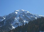
Vette Feltrine
| Cimony group | |
|---|---|
|
Busa di Vette in the middle of the Vette Feltrine with Monte Pietena , Vette Piccole, Col Cesta, Vette Grandi and Col di Luna |
|
| Highest peak | Sass de Mura ( 2547 m slm ) |
| location | Belluno Province , Trentino ( Italy ) |
| part of | Dolomites |
| Coordinates | 46 ° 7 ' N , 11 ° 51' E |
The Vette Feltrine , also Vette di Feltre , Vette Feltre , Le Vette or Cimonegagruppe is a southern subgroup of the Dolomites , which is located in the Italian provinces of Trentino and Belluno . On the Belluno side, it belongs to the Belluno Dolomites National Park and thus also to the Dolomites World Heritage Site . The highest peak is the 2547 m slm high Sass de Mura a little north of the center of the mountain group, through which the Dolomites high path 2 also leads.
Boundary
The Vette Feltrine is defined as follows:
Valle Schenner from Imèr - Val Cortella to Fonzaso - Feltriner Basin - Valle di Canzo - Valle delle Grave - Passo Finestra - Val Nagaoni - Val Noana to Imèr
Important peaks

- Pavion - 2334 m slm
- Col di Luna - 2295 m asl
- Cima Dodici - 2265 m slm
- Monte Ramezza - 2229 m slm
- Sasso Scarnia - 2226 m slm
- Monte Pietena - 2195 m asl
Refuges
- Rifugio Giorgo Dal Piàz - 1993 m slm
- Rifugio Bruno Boz - 1718 m slm
Valley locations
Literature and map
- Carlo Turchetto: Prealpi Venete in mountain bike. Ediciclo Editore , 1991, ISBN 8885327109
- Franz Hauleitner: Dolomites high trails 1–3: All stages. Volumes 1-3. Bergverlag Rother , 2015, ISBN 978-3-7633-3103-1 , pp. 126-134
- Compass maps , Trentino , sheet 683, map 2, 1: 50,000


