
Worpe
| Worpe | ||
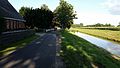
 The Wörpe in Lilienthal (Mühlendeich) |
||
| Data | ||
| Water code | EN : 4946 | |
| location | Districts of Rotenburg (Wümme) and Osterholz , Lower Saxony | |
| River system | Weser | |
| Drain over | Wümme → Lesum → Weser → North Sea | |
| source | Clarification ponds near Steinfeld (municipality of Bülstedt ) 53 ° 13 ′ 20 ″ N , 9 ° 11 ′ 51 ″ E |
|
| muzzle | at Lilienthal in the Wümme coordinates: 53 ° 8 '4 " N , 8 ° 53' 51" E 53 ° 8 '4 " N , 8 ° 53' 51" E
|
|
| length | 29.3 km | |
| Catchment area | 135.8 km² | |
| Discharge at the Grasberg A Eo gauge : 93.8 km² |
NNQ MNQ MQ Mq MHQ HHQ |
52 l / s 251 l / s 960 l / s 10.2 l / (s km²) 5.58 m³ / s 9.38 m³ / s |
| Discharge at the mouth of the A Eo : 135.8 km² |
MQ Mq |
1.38 m³ / s 10.2 l / (s km²) |
The Wörpe is a small tributary of the Wümme in northern Lower Saxony .
The headwaters of the Wörpe are located near Steinfeld about 10 kilometers southwest of Zeven . From there the Wörpe flows over Wilstedt and Grasberg (up to here the influence of the tide extends ) and finally flows into the Wümme at Lilienthal . In the upper reaches the brook flows in natural meanders . In the past, the lower reaches of the Wörpe were canalized and the water level was regulated by means of a river bed . The Wörpe originally ran through the Truper Blänken and flowed into the Wümme at the Gehrden farm. Between 1826 and 1864 there was an initial expansion phase to improve peat barge travel . From the 1990s onwards, the rocky slopes below Schnakenmühlen were converted into soles gliding .
The fishing and water protection association Lilienthal und Umgebung eV provides the water management for the Wörpe and is currently (2013) the resettlement of sea trout in the Wörpe.
gallery

At Grasberg
At Lilienthal

At Lilienthal

At Lilienthal

The mouth in Wümme near Lilienthal


.jpg)

Individual evidence
- ↑ Water and landscape care association Teufelsmoor: The precipitation area of the Wörpe ( page no longer available , search in web archives ) Info: The link was automatically marked as defective. Please check the link according to the instructions and then remove this notice. (PDF; 1.4 MB) , accessed on August 8, 2013
- ↑ a b Franzius Institute (University of Hanover): Flood Protection Plan Wümme Report No. 685, 2006, 276 pp. (PDF; 7.52 MB), accessed on August 10, 2013
- ↑ Grasberg level data extrapolated to the entire catchment area
- ↑ Fishing and water protection association Lilienthal und Umgebung eV
Web links
- The catchment area of the Wörpe (PDF; 1.4 MB), information from the Teufelsmoor water and landscape management association