Wad Madani
|
Arabic ود مدني Wad Madani |
||
|---|---|---|
|
|
||
| Coordinates | 14 ° 24 ' N , 33 ° 31' E | |
| Basic data | ||
| Country | Sudan | |
| Al-Jazeera | ||
| ISO 3166-2 | SD-GZ | |
| Residents | 368,021 (calculation 2009) | |
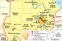
Wad Madani ( Arabic ود مدني Wad Madanī ; Alternative spelling Wad Medani ) is the capital of the Sudanese state of al-Jazira and is located in the center of a large cotton-growing area.
location
The city is located in the east of Sudan, around 150 km southeast of Khartoum on the road to Kassala , on the left bank of the Blue Nile , within the Jazira plain at an altitude of 409 meters above sea level.
population
For Wad Madani there are 368,021 inhabitants (calculation 2009).
Population development:
| year | Residents |
|---|---|
| 1956 (n / a) | 52,400 |
| 1973 (census) | 106,715 |
| 1983 (census) | 141.065 |
| 1993 (census) | 211,362 |
| 2009 (calculation) | 368.021 |
history
The city became a Turkish-Egyptian outpost in 1821 , from which the Sultanate of Sannar was conquered. In 1911 the first attempts to cultivate cotton began in the vicinity, and two years later it was decided to build the Sannar Dam . With that, the city was selected by the British in 1925 as the center of the ambitious Jazirah irrigation project, which in the following years led to rapid growth and the most modernized area in the country.
economy
The economy is still characterized by the irrigated fields in the flat Jazira plain. The city is located in a cotton-growing area and is a transshipment point for wheat , cotton and farm animals . As an excursion destination especially for honeymooners from Khartoum, Wad Madani has a corresponding hotel offer. The relative prosperity in the city can be seen in the houses in the central market area on the riverside. The range of fruit and vegetables on the market is above average.
The airport has the international identification DNI and a flight path length of 1097 meters.
education
In 1977 the University of Al-Jazeera was opened in the north of the city.
sons and daughters of the town
The city is the birthplace of the singer, band leader and oud player Abdel Aziz El Mubarak (1951–2020).
Climate table
| Wad Medani | ||||||||||||||||||||||||||||||||||||||||||||||||
|---|---|---|---|---|---|---|---|---|---|---|---|---|---|---|---|---|---|---|---|---|---|---|---|---|---|---|---|---|---|---|---|---|---|---|---|---|---|---|---|---|---|---|---|---|---|---|---|---|
| Climate diagram | ||||||||||||||||||||||||||||||||||||||||||||||||
| ||||||||||||||||||||||||||||||||||||||||||||||||
|
Average monthly temperatures and rainfall for Wad Medani
Source: wetterkontor.de
|
|||||||||||||||||||||||||||||||||||||||||||||||||||||||||||||||||||||||||||||||||||||||||||||||||||||||||||||||||||||||||||||||||||||||
Individual evidence
- ↑ Page no longer available , search in web archives:
Web links
- Wad Medani Online ( Memento from February 20, 2010 in the Internet Archive )


