Waitangi (Northland)
| Waitangi | ||
| Geographical location | ||
|
|
||
| Coordinates | 35 ° 16 ′ S , 174 ° 5 ′ E | |
| Region ISO | NZ-NTL | |
| Country |
|
|
| region | Northland | |
| District | Far North District | |
| Ward | Bay of Islands - Whangaroa Ward | |
| Residents | 39 (2013) | |
| height | 4 m | |
| Post Code | 0293 | |
| Telephone code | +64 (0) 9 | |
| UN / LOCODE | NZ WTG | |
| website | www.waitangi.org.nz | |
| Photography of the place | ||
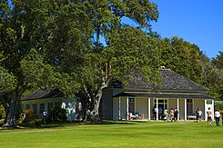
 The Treaty House , the place where the Treaty of Waitangi was signed |
||
Waitangi is the place in the Far North District of the Northland regionon the North Island of New Zealand , where the Treaty of Waitangi was signedon February 6, 1840.
geography
Waitangi , which essentially consists of the 506 hectare Waitangi National Reserve , is located directly adjacent north of Paihia and around 4 km west of Russell on the southwestern part of the Bay of Islands . The historic site can be reached via a 155 m long bridge from Paihia , which crosses the mouth of the Waitangi River and makes the site more accessible for tourists. From the north, Waitangi can also be reached via a country road that can be approached from Kerikeri and a second road that also makes Waitangi accessible from Haururu , located on New Zealand State Highway 11 .
story
The Treaty House , where on 6 February 1840 by 45 Māori - Chiefs of the northern tribes and Lieutenant-Governour William Hobson , representing the British Crown, the Treaty of Waitangi was signed, first belonged to the British Resident James Busby , the house, the built in 1832 for himself and his family in the Georgian style . After Busby's death, the house and land were initially owned by the family, but in later years it had different owners, until 1932 the house and land were acquired by the then Governor Charles Bathurst, 1st Viscount Bledisloe , and the New Zealand nation as a historical memorial was given as a gift.
With the Treaty of Waitangi New Zealand officially became a colony and thus belonged to the British Empire . This date is considered to be the "hour of birth" of modern New Zealand. Therefore, February 6th is the country's national holiday and is celebrated as Waitangi Day with a special ceremony throughout the country and at the historic site in Waitangi .
population
At the 2013 census, the town had 39 inhabitants.
Attractions
On the grounds of the Waitangi National Reserve , the Treaty House , a meeting house of the Māori ( Te Whare Runanga ), a flagpole, a boathouse with traditional canoes ( waka ), a small forest with subtropical plants and trees and a museum can be visited.
literature
- Helga Neubauer: Waitangi . In: The New Zealand Book . 1st edition. NZ Visitor Publications , Nelson 2003, ISBN 1-877339-00-8 , pp. 146-152 .
Web links
- Homepage . Waitangi Treaty Grounds,accessed October 25, 2017.
Individual evidence
- ↑ a b 2013 Census QuickStats about a place : Waitangi . Statistics New Zealand , accessed on October 25, 2017 (English, StatsMap: Meshblock evaluation from the interactive map, see Mashblocks 0051101, 0051102).
- ↑ Topo250 maps . Land Information New Zealand , accessed October 25, 2017 .
- ^ Neubauer: Waitangi . In: The New Zealand Book . 2003, p. 146 .
- ^ Neubauer: Waitangi . In: The New Zealand Book . 2003, p. 147 .
- ↑ Homepage . Waitangi Treaty Grounds , accessed October 25, 2017 .
