Waldbach (Gabelbach)
|
Waldbach Oberlauf: Mangelsbach ( Historically : Wattbach ) |
||
|
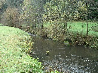
The forest stream west of Kirchzell |
||
| Data | ||
| Water code | DE : 247224 | |
| location |
Odenwald
|
|
| River system | Rhine | |
| Drain over | Gabelbach → Mud → Main → Rhine → North Sea | |
| source | east of Mangelsbach 49 ° 40 ′ 9 ″ N , 9 ° 5 ′ 19 ″ E |
|
| Source height | 480 m above sea level NN | |
| muzzle | near Kirchzell in den Gabelbach Coordinates: 49 ° 36 '37 " N , 9 ° 9' 43" E 49 ° 36 '37 " N , 9 ° 9' 43" E |
|
| Mouth height | 200 m above sea level NN | |
| Height difference | 280 m | |
| Bottom slope | 26 ‰ | |
| length | 10.6 km | |
| Catchment area | 27.3 km² | |
| Right tributaries | Heinstermühlbach | |
The Waldbach is a left tributary of the Gabelbach in the Hessian and Bavarian Odenwald .
geography
course
The forest creek rises as lack Bach on the border between Hesse and Bavaria east of lack Bach , a hamlet in the district of Michelstädter district Würzberg . It flows as a border stream in a south-easterly direction to the Schrahmühle . There he takes up the Wilbesbach from the right. From there on it bears the name Waldbach. It runs via Watterbach parallel to district road 7 to Kirchzell , where it joins the Gabelbach from the left at a campsite .
Tributaries
- Heinstermühlbach (right)
- Wilbesbach (right)
- Breitenbucher blade (right)
Mud river system
Web links
Commons : Waldbach (Gabelbach) - Collection of images, videos and audio files
