Wassyugan
|
Vasyugan River Васюган, Wasjugan, Vasyugan |
||
|
Topographic map of Vasyugan Tundra (1882) |
||
| Data | ||
| Water code | RU : 13010800112115200029649 | |
| location | Tomsk Oblast ( Russia ) | |
| River system | If | |
| Drain over | Whether → Arctic Ocean | |
| Headwaters | Wassyugan moors | |
| Source height | approx. 140 m | |
| muzzle | in the Ob near Kargassok coordinates: 59 ° 5 ′ 35 ″ N , 80 ° 42 ′ 25 ″ E 59 ° 5 ′ 35 ″ N , 80 ° 42 ′ 25 ″ E |
|
| Mouth height | 45 m | |
| Height difference | approx. 95 m | |
| Bottom slope | approx. 0.09 ‰ | |
| length | 1080 km | |
| Catchment area | 61,800 km² | |
| Discharge at the Maisk A Eo gauge : 3730 km² Location: 860 km above the mouth |
MQ 1955/2000 Mq 1955/2000 |
15.3 m³ / s 4.1 l / (s km²) |
| Discharge at the Nowy Wassjugan A Eo gauge : 19,000 km² Location: 576 km above the mouth |
MQ 1960/2000 Mq 1960/2000 |
84 m³ / s 4.4 l / (s km²) |
| Discharge at the Sredny Wassjugan A Eo gauge : 31,700 km² Location: 270 km above the mouth |
MQ 1936/2000 Mq 1936/2000 |
160 m³ / s 5 l / (s km²) |
| Discharge at the Naunak A Eo gauge : 58,300 km² Location: 63 km above the mouth |
NNQ (1957) MNQ 1957/1971 MQ 1957/1971 Mq 1957/1971 MHQ 1957/1971 HHQ (1970) |
45.7 m³ / s 155.97 m³ / s 327.64 m³ / s 5.6 l / (s km²) 507.57 m³ / s 1340 m³ / s |
| Left tributaries | Tschertala , Jagyljacha | |
| Right tributaries | Nyurolka , Tschischapka | |
| Communities | Novy Vasyugan | |
| Navigable | at a distance of 886 km from the estuary | |
|
The Wassyugan river in Tomsk region, Siberia, view from the helicopter. |
||
|
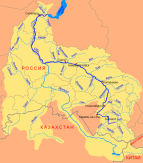
Course of the Wassjugan (Васюган) in the catchment area of the Ob |
||
The 1,082 km long Wassjugan ( Russian Васюган ; also Wasjugan , Vasyugan ) is a left tributary of the Ob in Siberia ( Russia , Asia ).
The Wassjugan rises in the northern part of the Wassjugan Moors (see also Wassjuganje ), the largest moor system in the world with an area of more than 50,000 km² and 14 billion tons of peat in layers up to 10 meters thick, in the West Siberian lowlands near the border between Oblast Tomsk and Oblast Novosibirsk at about 140 m . In the further course it flows strongly meandering in a wide arc through the Oblast Tomsk and finally flows below Kargassok into the Ob. In the lower reaches, in particular, the river forms a multitude of arms, shoals and islands, in the floodplain there are many lakes and oxbow lakes. The actual mouth is that of an arm of the river 11 km below the settlement of Kargassok (45 m above sea level). Near the mouth, the river is approx. 190 m wide and 2.3 m deep; the flow velocity is 0.8 m / s.
The catchment area covers 61,800 km². The mean monthly water flow at Naunak, 63 km from the estuary, is 328 m³ / s (minimum in February: 81.6 m³ / s, maximum in June: 951 m³ / s). According to other sources, the mean discharge at Naunak is 381 m³ / s.
Wassyugan freezes from November to May.
It is navigable to the village of Novy Vasyugan (593 km). In the Wassjugan catchment area, oil and natural gas are produced .
The main tributaries are from the right Nyurolka (Нюролька; 60 km navigable) and Tschischapka (Чижапка), from the left Tschertala (Чертала) and Jagyljacha (Ягылъяха).
See also
Individual evidence
- ↑ a b Wassjugan in the State Water Directory of the Russian Federation (Russian)
- ↑ a b c Article Vasyugan in the Great Soviet Encyclopedia (BSE) , 3rd edition 1969–1978 (Russian)
- ↑ Wassjugan at the Maisk gauge - hydrographic data at R-ArcticNET
- ↑ Wassjugan at the Nowy Wassjugan gauge - hydrographic data from R-ArcticNET
- ↑ Wassjugan at the Sredny Wassjugan gauge - hydrographic data at R-ArcticNET
- ↑ Wassjugan at the Naunak gauge - hydrographic data from R-ArcticNET
swell
- List of Inland Waterways of the Russian Federation (Government Decree of December 19, 2002, Russian)


