Wendefurth
|
Wendefurth
City of Thale
Coordinates: 51 ° 44 ′ 29 ″ N , 10 ° 55 ′ 21 ″ E
|
|
|---|---|
| Height : | 340 m above sea level NN |
| Incorporated into: | Altenbrak |
| Postal code : | 06502 |
| Area code : | 039456 |
|
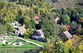
View of Wendefurth from the dam of the dam
|
|
Wendefurth has been a district of Thale in the Harz district of Saxony-Anhalt since July 1, 2009 . Before that, the hamlet belonged to the Altenbrak community , which was incorporated into Thale.
history
Wendefurth was first mentioned in 1573 together with an ironworks and a water mill.
Wendefurth was named after a ford leading through the Bode , in the place of which a bridge was built in 1733, which was blown up in April 1945 and then replaced by a new building.
Geographical location
Wendefurth is located in the Harz low mountain range within the Harz / Saxony-Anhalt nature reserve . It is located 8.5 km west-southwest of the Thaler core town in the deeply incised Bodetal through which the Bode flows. Directly to the west above the hamlet, the river is dammed by the Wendefurth dam with the attached Wendefurth pumped storage plant ; Above this dam is the nearby Rappbodetalsperre . The mountains around Wendefurth include the Wendefurther Berg ( 446.1 m ) in the north, the Armsberg ( 435.2 m ) in the east to the southeast and the Kirchhofsberg ( 452.3 m ) in the southwest.
The federal road 81 runs through the hamlet between Hasselfelde and Wienrode . The Harz Hexenstieg runs nearby .
Web links
- Almsfeld & Wendefurth in: Thale and its districts , on bodetal.de
Individual evidence
- ^ Bruno Benthien: GDR travel guide . Tourist Verlag, 1990, ISBN 978-3-350-00321-1 , pp. 237 ( limited preview in Google Book search).
- ↑ Wendefurth in the Harz Mountains. In: harzlife.de. Retrieved August 16, 2017 .
