Westerende-Kirchloog
|
Westerende-Kirchloog
Ihlow parish
Coordinates: 53 ° 26 ′ 12 " N , 7 ° 25 ′ 22" E
|
|
|---|---|
| Residents : | 1721 (May 2017) |
| Incorporation : | July 1, 1972 |
| Postal code : | 26632 |
| Area code : | 04941 |
|
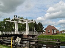
Ring canal in Westerende-Kirchloog with a former towpath
|
|
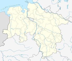
Location of Westerende-Kirchloog in Lower Saxony |
Westerende-Kirchloog has been part of the East Frisian community of Ihlow in Lower Saxony since the municipal reform of July 1, 1972 . The place had around 1721 inhabitants in May 2017.
location
The place is about 5 kilometers from Aurich . The name Westerende probably originated from its location, a little west of Aurich. The place borders on the Aurich districts Extum and Rahe .
history
The place was first mentioned in writing in 1408. The eastern part of Westerende from the Ems-Jade Canal is called "flag", which is said to have been the most original name for the entire village.
Attractions
Worth seeing in Westerende-Kirchloog is the medieval Evangelical Lutheran St. Martins Church , a brick church, the altar of which was built in 1652 by Pastor Hermann de Werve and his wife Emerentia de Wervine. Craeftin was donated.
Economy and Infrastructure
On the Ems-Jade Canal , the successor to the low-level trek between Emden and Aurich, which was created in 1798/99 , there is a sports boat harbor and the Voss shipyard .
Boats up to 14 meters in length and four meters in width can moor in the sports boat harbor. The second basin belongs to the Voss shipyard, where ships up to around 50 meters in length can be pulled onto the slipway . Around 128 cutters of the 300 hp class were built here and are still being repaired or extended today.
The nine-kilometer-long ring canal runs through Westerende-Kirchloog, and starts at the barrage near East-Victorbur and ends at the Ems-Jade Canal. It used to be used as a waterway for peat barges, but today it has mainly a drainage function, but is also used by small pleasure craft. In order to emphasize the historical reference, a landing stage has been created at the Moordorf Moor Museum . The ring canal is five to 13 meters wide with a water depth of 0.60 to 1.40 meters.
Web links
- Westerende-Kirchloog . Ihlow parish. Retrieved October 22, 2013.
Individual evidence
- ^ Federal Statistical Office (ed.): Historical municipality directory for the Federal Republic of Germany. Name, border and key number changes in municipalities, counties and administrative districts from May 27, 1970 to December 31, 1982 . W. Kohlhammer GmbH, Stuttgart and Mainz 1983, ISBN 3-17-003263-1 , p. 261 .
- ↑ Westerende-Kirchloog - Ihlow community . Ihlow parish. Retrieved May 20, 2018.
- ↑ Parishes of the East Frisian Peninsula: The ev.-luth. St. Martinskirche ( Memento of the original from March 4, 2016 in the Internet Archive ) Info: The archive link was inserted automatically and has not yet been checked. Please check the original and archive link according to the instructions and then remove this notice. Retrieved March 4, 2009
- ↑ Boat tourism in East Frisia. Accessed on March 4, 2009


