Ludwigsdorf (Ihlow)
|
Ludwigsdorf
Ihlow parish
Coordinates: 53 ° 24 ′ 45 " N , 7 ° 27 ′ 25" E
|
|
|---|---|
| Height : | 3 m above sea level NN |
| Residents : | 921 (Oct. 2013) |
| Incorporation : | July 1, 1972 |
| Postal code : | 26632 |
| Area code : | 04941 |
Ludwigsdorf has been part of the East Frisian municipality of Ihlow in Lower Saxony since the municipal area reform of July 1, 1972 . The place had 921 inhabitants in October 2013.
location
Ludwigsdorf is located in the north of the municipality of Ihlow and borders the Aurich districts of Rahe and Kirchdorf .
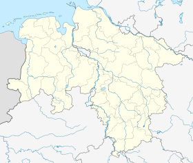
Location of Ludwigsdorf in Lower Saxony |
history
The first settlers in the former bog colony settled in 1793 east of Münkewegs that from Ihlow forest to Wester-Kirchloog leads down. In 1798 other settlers from Lübbertsfehn and Schirum followed in what was then known as the moor colony near Ihlow . The first settlers suffered mainly from poor drainage. They tried several times to build a canal, but did not get a permit. In 1801 the first public award of 11 colonies began in the village, which was named in 1806 after the President of the War and Domain Chamber in Aurich, Ludwig von Vincke , Ludwigsdorf. Inadequate drainage, the lack of solid roads and the associated major problems caused many settlers to emigrate to America from 1865 onwards.
The last colonies were awarded in 1881/82. By 1900 the development of the place was largely completed. Peat cutting played an economic role in summer and forestry in winter . From 1902 to 1914 there was also a brick factory. The place was only connected to the road network after the Second World War. Today Ludwigsdorf is a place for commuters . Most of its residents have their jobs in Emden or Aurich.
Population development
| year | Residents |
|---|---|
| 1925 | 449 |
| 1933 | 490 |
| 1939 | 495 |
| 1961 | 687 |
| 1970 | 799 |
| 2009 | 923 |
| 2013 | 921 |
Web links
- Ludwigsdorf . Ihlow parish. Retrieved October 20, 2013.
Individual evidence
- ↑ a b c Federal Statistical Office (ed.): Historical municipality directory for the Federal Republic of Germany. Name, border and key number changes in municipalities, counties and administrative districts from May 27, 1970 to December 31, 1982 . W. Kohlhammer GmbH, Stuttgart and Mainz 1983, ISBN 3-17-003263-1 , p. 261 .
- ↑ a b Ludwigsdorf . Ihlow parish. Archived from the original on October 6, 2013. Info: The archive link was inserted automatically and has not yet been checked. Please check the original and archive link according to the instructions and then remove this notice. Retrieved October 20, 2013.
- ↑ a b c Ihlow parish: From the story of Ostersander , accessed on January 14, 2010
- ↑ a b Bernhard Buttjer; Martin Stromann: Where the monks once lived: The Ihlow monastery, a forest and twelve villages . Verlag SKN, Norden (Ostfriesland) 2009, ISBN 3-939870-22-6 , p. 123.
- ^ A b c Michael Rademacher: German administrative history from the unification of the empire in 1871 to the reunification in 1990. aurich.html. (Online material for the dissertation, Osnabrück 2006).
