Riepster Hammrich
|
Riepster Hammrich
Ihlow parish
Coordinates: 53 ° 22 ′ 35 ″ N , 7 ° 19 ′ 9 ″ E
|
|
|---|---|
| Residents : | 139 (Oct. 2013) |
| Incorporation : | July 1, 1972 |
| Postal code : | 26632 |
| Area code : | 04943 |
|
The Riepster Hammrich
|
|
The Riepster Hammrich (also: Riepsterhammrich) is an area of fields, meadows and pastures with individual agricultural farms located near the town of Riepe . Today it forms part of the municipality of Ihlow in the Aurich district in East Friesland with 139 inhabitants in October 2013.
location
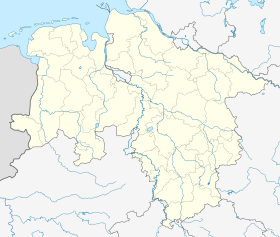
Location of Riepster Hammrich in Lower Saxony |
The Riepster Hammrich used to be consistently a meadow moor area below sea level, only covered with a thin marsh blanket , which had to be kept dry with scoop mills. More than 2100 hectares of the Riepster Hammrichs were washed up with Ems Schlick about one meter in the 20th century , which has permanently changed the soil structure and landscape character.
The community Riepsterhammrich (with this spelling) was incorporated into the new community Ihlow on July 1, 1972.
The Riepster Hammrich is cut through by the A 31 , which connects Emden with Oberhausen . By removing sand for the motorway, several lakes (in East Friesland "seas") have been deepened, including the Bansmeer ( nature reserve ) and the Uphuser Meer (holiday and weekend settlement), into which the ridding flowed up to the gorge.
Individual evidence
- ↑ Riepsterhammrich . Ihlow parish. Archived from the original on October 6, 2013. Info: The archive link was inserted automatically and has not yet been checked. Please check the original and archive link according to the instructions and then remove this notice. Retrieved October 22, 2013.
- ^ Federal Statistical Office (ed.): Historical municipality directory for the Federal Republic of Germany. Name, border and key number changes in municipalities, counties and administrative districts from May 27, 1970 to December 31, 1982 . W. Kohlhammer GmbH, Stuttgart and Mainz 1983, ISBN 3-17-003263-1 , p. 261 .

