Ihlowerhörn
|
Ihlowerhörn
Ihlow parish
Coordinates: 53 ° 23 ′ 6 ″ N , 7 ° 29 ′ 3 ″ E
|
|
|---|---|
| Height : | 3 m above sea level NN |
| Residents : | 1094 (Oct. 2013) |
| Incorporation : | July 1, 1972 |
| Postal code : | 26632 |
| Area code : | 04929, 04945 |
|
Nikolaikirche Weene
|
|
The former municipality of Ihlowerhörn has been part of the East Frisian municipality of Ihlow in Lower Saxony since the municipal reform of July 1, 1972 . The district is divided into the villages Westersander , Hüllenerfehn , Ihlowerhörn and Lübbertsfehn , from which the municipality of Ihlowerhörn was formed in 1939 and had 1,094 inhabitants in October 2013.
location
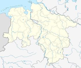
Location of Ihlowerhörn in Lower Saxony |
history
The earliest evidence for the presence of humans in the area of today's district are finds from the Stone Age. It is believed that Westersander, located on the Geest , was founded by settlers from Shirum in the early Middle Ages before the year 1000.
The settlement of the other villages began in 1637 on the initiative of Emden merchants who were cut off from peat deliveries from the Netherlands due to the Thirty Years' War . In that year Lübbert Cornelius bought an area that was originally called Ostersander Vehn , but was later named Lübbertsfehn after its founder . The first settlers were assigned to Weene in the church . A fact that has remained to this day.
On the initiative of Rudolf Pott, who also came from Emden, the construction of the Hüllenerfehn began two years later. Pott had taken over 100 Diemat Morast from the Counts of East Friesland in hereditary lease. The place was initially called Westersander Vehn , it was later renamed Pottsfehn, and finally Hüllenerfehn because of the hilly surroundings.
The Christmas flood of 1717 hit the villages hard. In Hüllenerfehn alone, seven people drowned and the livestock suffered heavy losses. In 1911 the places were connected to the road network, which meant the decline of the previously predominant river navigation .
Today the place is characterized by agriculture.
Web links
- Ihlowerhörn . Ihlow parish. Retrieved October 20, 2013.
Individual evidence
- ^ Federal Statistical Office (ed.): Historical municipality directory for the Federal Republic of Germany. Name, border and key number changes in municipalities, counties and administrative districts from May 27, 1970 to December 31, 1982 . W. Kohlhammer GmbH, Stuttgart and Mainz 1983, ISBN 3-17-003263-1 , p. 261 .
- ↑ Ihlowerhörn . Ihlow parish. Archived from the original on April 6, 2014. Info: The archive link was inserted automatically and has not yet been checked. Please check the original and archive link according to the instructions and then remove this notice. Retrieved October 20, 2013.
- ^ Bernhard Buttjer; Martin Stromann: Where the monks once lived: The Ihlow monastery, a forest and twelve villages . Verlag SKN, Norden (Ostfriesland) 2009, ISBN 3-939870-22-6 , p. 127.
- ^ University of Göttingen. Geographical Institute: Göttingen geographical treatises , issues 37–38, p. 44.
- ^ Bernhard Buttjer; Martin Stromann: Where the monks once lived: The Ihlow monastery, a forest and twelve villages . Verlag SKN, Norden (Ostfriesland) 2009, ISBN 3-939870-22-6 , p. 122.
- ^ Arend Remmers : From Aaltukerei to Zwischenmooren. The settlement names between Dollart and Jade. Verlag Schuster, Leer 2004, ISBN 3-7963-0359-5 , p. 111/143

