
Westerfeld
|
Westerfeld
City of Neu-Anspach
|
|
|---|---|
 |
|
| Height : | 288 m above sea level NHN |
| Area : | 5.51 km² [LAGIS] |
| Residents : | 1325 (December 31, 2015) |
| Population density : | 240 inhabitants / km² |
| Incorporation : | December 31, 1971 |
| Postal code : | 61267 |
| Area code : | 06081 |
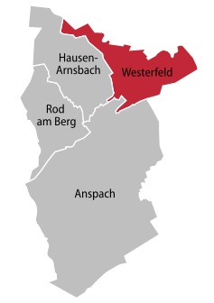  Location of Westerfeld in Neu-Anspach
|
|


Westerfeld is a district of Neu-Anspach in the Hochtaunuskreis in southern Hesse .
geography
Westerfeld is located between Usingen and Hausen-Arnsbach , about four kilometers west of Wehrheim in the Usa Valley . Several streams, including the Arnsbach , flow into the United States in the district of Westerfeld .
history
In 1274, Westerfeld was first mentioned as the youngest part of Neu-Anspach.
On December 31, 1971, Westerfeld became the fourth district of the community of Neu-Anspach as part of the regional reform in Hesse .
coat of arms
From 1816 an ear of corn is included in the symbols of the village. The current shape of five golden ears of wheat on a blue background has been used since 1945. In the coat of arms of the city of Neu-Anspach, an ear of corn in the lower left corner refers to the coat of arms of Westerfeld.
Attractions
Infrastructure
The city of Neu-Anspach operated a community hall above the fire station until mid-2013, which now serves as a practice room and club house for the Grün-Gelb Neu-Anspach dance sports club.
In mid-2013 the fire brigade housed under the village hall was disbanded. Operations in this area are now being carried out by the fire department in the Anspach district.
A primary school had existed in Westerfeld since 1817 . In 1908 a new school building was built. In 1965, the Adolf Reichwein School in Anspach became a central elementary school. Since then there has not been a school of its own in Westerfeld .
The church on the Kirchberg dates back to 1720. The builder was Benedikt Burtscher. At that time it replaced an existing small chapel. For the new building in 1720, all of Usinger Land were collected with the consent of Princess Charlotte Amalie. Until 1981 Westerfeld belonged to Usingen, today it is part of Neu-Anspach.
The former Brandholz waste dump is located above Westerfeld .
In the western district of Westerfeld, new building plots are being built that will be offered for sale by the city of Neu-Anspach from autumn 2014.
Web links
- Internet presence of the city of Neu-Anspach
- Westerfeld, Hochtaunuskreis. Historical local dictionary for Hessen. (As of March 28, 2014). In: Landesgeschichtliches Informationssystem Hessen (LAGIS).
- Literature about Westerfeld in the Hessian Bibliography
Individual evidence
- ↑ Numbers and facts about the city of Neu-Anspach: residents HW , accessed in July 2016
- ↑ Eugen Ernst: The Neu-Anspach settlement structure in time and space. fourth volume of the series of publications of the home and history association Neu-Anspach.
- ^ Federal Statistical Office (ed.): Historical municipality directory for the Federal Republic of Germany. Name, border and key number changes in municipalities, counties and administrative districts from May 27, 1970 to December 31, 1982 . W. Kohlhammer GmbH, Stuttgart and Mainz 1983, ISBN 3-17-003263-1 , p. 379 .
- ↑ Coat of arms: sometimes proud, sometimes modest; in: Taunuszeitung from November 25, 2017, p. 21
- ^ History of the ARS.
- ↑ Frank Salt Berger not look Lieber in Wikipedia ; in Taunus Zeitung Volume 144 No. 133 from June 10, 2020, p. 16
- ↑ Westerfeld parish.
- ↑ Development sites (as of September 2014)
