Windorah
| Windorah | |||||||
|---|---|---|---|---|---|---|---|
 Solar farm |
|||||||
|
|||||||
|
|||||||
|
|||||||
|
|||||||
|
|
|||||||
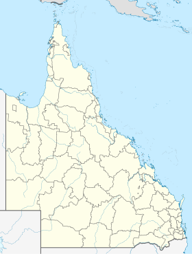
Windorah is a small town with 115 inhabitants in the southwest of the Australian state of Queensland . It is located in the outback about 1200 kilometers west of Brisbane and 300 kilometers southwest of Longreach on the Diamantina Developmental Road . It is only one of three places in the thinly populated administrative area (LGA) of Barcoo Shire . The place is named after an Aboriginal name for the place of the big fish .
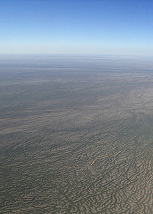
35 kilometers upstream from Windorah, the Thomson and Barcoo Rivers form the mighty Cooper Creek . In the event of flooding during the rainy season , it forms a river course up to 100 km wide in numerous canals. Most of the time, Cooper Creek has no water and consists of a large number of water holes, the largest of which can be up to 19 km long and 10 m deep. For this reason, Windorah, along with Birdsville , is often referred to as the Heart of the Channel Country .
Sheep and cattle farming are the main industries in the area, with the gas and oil industries developing in the area in the recent past. Many residents are busy maintaining the dingo fence .
In 2008, a solar power plant with a peak output of 130 kWp and an annual output of 360,000 kWh was installed in Windorah . It consists of five parabolic mirrors with a diameter of 13.7 meters and it is supported by diesel generators .
Windorah Airport is about a kilometer north of the city.
climate
The climate of Windorah is very diverse. In summer temperatures reach almost 50 ° C, in winter they drop below 0 ° C. The annual rainfall varies between 86 mm minimum to 988 mm maximum. Other weather extremes are 25 frost days in 1977, ten sandstorms in 1987 and four hailstorms in 1985.
|
Average monthly temperatures and rainfall for WINDORAH POST OFFICE - Altitude: 126 m from 1931 to 2011
Source:
|
|||||||||||||||||||||||||||||||||||||||||||||||||||||||||||||||||||||||||||||||||||||||||||||||||||||||||
Individual evidence
- ↑ a b Climate statistics for Australian locations (WINDORAH POST OFFICE) ( English ) Australian Government - Bureau of Meteorologie . Retrieved June 6, 2009.
- ↑ a b Australian Bureau of Statistics : Windorah ( English ) In: 2016 Census QuickStats . June 27, 2017. Retrieved April 15, 2020.
- ↑ Environmental Protection Agency (Queensland) : Heritage Trails of the Queensland Outback . State of Queensland, 2002, ISBN 0-7345-1040-3 , p. 127.
- ↑ a b Queensland's Outback - Windorah , www.queenslandholidays.com.au. Retrieved November 19, 2011.
- ↑ Windorah Solar Farm - A Beacon of Sunlight ( Memento from November 17, 2010 in the Internet Archive ) (PDF; 641 kB), www.ergon.com.au. Retrieved November 20, 2011.

