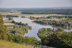
Xaver Hafner Bridge
Coordinates: 48 ° 53 ′ 27 " N , 12 ° 42 ′ 46" E
| Xaver Hafner Bridge | ||
|---|---|---|
| Xaver Hafner Bridge from Bogenberg seen from | ||
| Official name | Xaver Hafner Bridge | |
| use | Road bridge | |
| Convicted | District road SR 22 | |
| Crossing of |
Danube at km 2308.4 formerly SR 12 district road |
|
| place | Ainbrach (municipality of Aiterhofen ), Hofweinzier (town of Bogen ) | |
| Entertained by | District of Straubing-Bogen | |
| construction | Deck bridge, girder bridge | |
| overall length | 604 m | |
| width | 14 m | |
| Longest span | 154 m | |
| Construction height | 3.2 m to max. 8 m | |
| Headroom | 9 m | |
| building-costs | 29.5 million DM | |
| start of building | Fall 1982 | |
| opening | September 19, 1986 | |
| planner | IPG ing-plan / Dipl.-Ing. Berger | |
| location | ||
|
|
||
The Xaver Hafner Bridge , named after the politician Franz Xaver Hafner , connects the town of Bogen in the north with Aiterhofen in the south in the Straubing-Bogen district . The bridge crosses the Danube at river kilometers 2,308,400 along the SR 22 district road .
construction
superstructure
Is a partially haunched prestressed -Hohlkasten bridge from eight fields with a total span of 604 meters. The superstructure consists of a single-cell, transversely pre-tensioned box girder with a construction width of 14 meters and a carriageway with a cross-section of 8.5 meters with sidewalks on both sides. The construction height of the superstructure in the area of the approach bridges is 3.20 meters. The construction height of the river bridge reaches up to 8.00 meters directly above the two river piers. The spans are (from north to south) 64.5 - 78 - 154 - 78 - 59 - 59 - 59 - 52.5 meters. The relevant lower edge of the construction above the waterway is at a height of 323.72 m above sea level. NN .
Substructures
The two river piers rest on flat foundations and have reinforced concrete hollow cross-sections with natural stone facing. The foreland piers with full cross-section and the abutments are founded on large bored piles .
Construction work
The flow port and the two subsequent fields are in each case 14 clocks in cantilever performed by the Flußpfeilen forth. The approach bridges were concreted field by field.
history
Until the completion of the new bridge in 1986, the Danube could only be crossed in this area by water. The closest road bridges were in Straubing and Deggendorf .
The first efforts to create a Danube crossing at this point were made in 1927 when the citizens of Hermannsdorf and Ainbrach applied for a bridge over the Danube. From 1949, talks were held between the district administrators of the two districts of Bogen and Straubing concerned about a bridge location between Hofweinzier and Ainbrach. Again and again new efforts failed because of the financing. It was not until 1977 that the prospect of a high subsidy rate became apparent. The planning approval procedure was initiated in 1979 by the Straubing-Bogen district . The groundbreaking ceremony took place on November 3, 1982. On August 14, 1986, the district council set the name to Bogenberg Bridge . It was opened to traffic on September 19, 1986. It was later renamed Xaver-Hafner-Brücke .
Other names
The former official name was Bogenberg Bridge . The Federal Waterways and Shipping Administration refers to this bridge in its publications as Strassenbrücke Bogen and lists it under BW No. 30a .
Some reports in the local press incorrectly use the Franz-Xaver-Hafner Bridge .
Bridge sculpture
The bridge sculpture created by the sculptor Hans Rieser stands at a parking lot on the SR 22 district road southwest of Ainbrach .
literature
- Alfred Kleinwechselter: Bogenberg Bridge: Festschrift traffic opening September 19, 1986 . Ed .: District of Straubing-Bogen. September 19, 1986.
Web links
Individual evidence
- ↑ Sign on the bridge near Ainbrach
- ↑ Directory of the bridge clearance heights / widths in the district of WSD South. (PDF) (No longer available online.) Federal Waterways and Shipping Administration , May 2013, archived from the original on December 27, 2013 ; Retrieved August 4, 2014 .
- ↑ Arch road bridge. In: WMS Inland ENCs. Federal Waterways and Shipping Administration , archived from the original on August 4, 2014 ; Retrieved August 4, 2014 .
- ↑ plan approval; Appendix 193a; Federal waterway Danube; Expansion of the waterway and improvement of the Straubing – Vilshofen flood protection; Section 1: Straubing – Deggendorf. (PDF) List of buildings. (No longer available online.) RMD Wasserstraßen GmbH, April 20, 2015, p. 33 , archived from the original on October 22, 2016 ; accessed on October 23, 2016 . Info: The archive link was inserted automatically and has not yet been checked. Please check the original and archive link according to the instructions and then remove this notice.


