Xo'jayli
|
Xoʻjayli Хўжайли |
||
|
karak. : Xo'jeli (Хожели) |
||
| Basic data | ||
|---|---|---|
| State : |
|
|
| Autonomous Republic: |
|
|
| Coordinates : | 42 ° 24 ' N , 59 ° 26' E | |
|
|
||
| Height : | 73 m | |
| Residents : | 104,589 (2009) | |
| Telephone code : | (+998) 6155 | |
| Postal code : | 231500 to 231505 | |
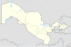
Xo'jayli ( Cyrillic Хўжайли ; Karakalpak Xo'jeli , Cyrillic Хожели ; Russian Ходжейли Chodschejli ) is a city in which to Uzbekistan belonging to the Autonomous Republic of Karakalpakstan , located about 10 km west-southwest of the karakalpakischen capital Nukus on 73 m above sea level south of the Amu Darya .

Xoʻjayli is an independent city and also the capital of the Xoʻjayli district of the same name . According to the 1989 population census, Xoʻjayli had 59,500 inhabitants at that time, according to a calculation for 2009 the population is 104,589. Xoʻjayli is the city with the second largest population in Karakalpakistan.
Xoʻjayli gained city status in 1926. In Xoʻjayli, cotton , shipyards , the carpet and the food industry are of economic importance . The city lies on the railway line from Türkmenabat in Turkmenistan to Makat in Kazakhstan and has a train station.
See also
Individual evidence
- ↑ Page no longer available , search in web archives: bevoelkerungsstatistik.de
- ↑ Article Xoʻjayli in the Great Soviet Encyclopedia (BSE) , 3rd edition 1969–1978 (Russian)
