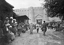
Turkmenabat
| Turkmenabat | ||
|---|---|---|
| Туркменабад | ||
|
||
| State : |
|
|
| Province : | Lebap welaýaty | |
| Coordinates : | 39 ° 5 ' N , 63 ° 35' E | |
| Height : | 191 m. ü. M. | |
| Residents : | 234,828 | |
|
|
||
Türkmenabat ( Russian Туркменабад Turkmenabad ; formerly Turkmen Чәрҗев / Çärjew , Russian Чарджоу), formerly known in German as Tschardschou , is the second largest city in Turkmenistan . Türkmenabat has 234,828 inhabitants.
Location and infrastructure
The city is located in the Lebap province in the north-east of the country, near the Uzbek border and about 500 km from the Afghan border. Türkmenabat is located on the Amu Darya , which is crossed by a railway bridge and a pontoon bridge for road traffic (as of 2015), which will be replaced by a fixed bridge currently under construction. Turkmenabat also has one of the most important ports on the Amu Darya.
The city lies on the route of the Trans-Caspian Railway with a branch to Urgensch and on to Astrakhan . Türkmenabat is the most important industrial center of the state; there is processing of the country's products, such as cotton and sheepskin . There are also industries for everyday needs, technical schools and a university. Türkmenabat owns the national airport Türkmenabat .
history
The city was founded in 1886 as part of the construction work to extend the Trans-Caspian Railway in the region as a Russian base. Until 1999, Turkmenabat had the old name: Çärjew (Turkmen) or Tschardschou (Russian). Subsequently, the city was renamed Turkmenabat by the Turkmen dictator Saparmyrat Nyýazow , known for his personality cult .
In 2006, more than 500 statues and large portraits of the former President of Turkmenistan were in the city.
See also : List of cities in Turkmenistan
Attractions
The most striking places in and around Türkmenabat include:
- The Dunya Bazaar with a wide range of goods from Turkmenistan, the People's Republic of China , Uzbekistan, Turkey and Russia
- The Allamberdar mausoleum from the 11th century AD
- The remains of the 10th century Amul settlement
- The ruins of the Dayakhatyn caravanserai
Climate table
| Turkmenabat | ||||||||||||||||||||||||||||||||||||||||||||||||
|---|---|---|---|---|---|---|---|---|---|---|---|---|---|---|---|---|---|---|---|---|---|---|---|---|---|---|---|---|---|---|---|---|---|---|---|---|---|---|---|---|---|---|---|---|---|---|---|---|
| Climate diagram | ||||||||||||||||||||||||||||||||||||||||||||||||
| ||||||||||||||||||||||||||||||||||||||||||||||||
|
Monthly average temperatures and rainfall for Türkmenabat
Source: wetterkontor.de
|
|||||||||||||||||||||||||||||||||||||||||||||||||||||||||||||||||||||||||||||||||||||||||||||||||||||||||||||||||||||||||||||||||||||||||||||||||||||||||||||||||||||
sons and daughters of the town
- Ramiz Mustafayev (1926–2008), Soviet-Azerbaijani composer, conductor and music teacher
- Bulat Mansurow (1937-2011), Soviet director
- Oleg Kononeko (* 1964), Russian cosmonaut
- Serdar Hudaýberdiýew (* 1986), Turkmen boxer
- Gülbadam Babamyratowa (* 1991), Turkmen martial artist
Web links
Individual evidence
- ↑ Turkmenabat | Turkmenistan. Retrieved June 9, 2019 .
- ↑ http://lenta.ru/news/2007/05/28/takedown/
- ↑ Turkmenabad Landmarks - Allamberdar (Almutasir) Mausoleum. Retrieved June 9, 2019 .
- ↑ Turkmenabad Landmarks - Amul Settlement. Retrieved June 9, 2019 .
- ↑ Turkmenabad Landmarks - Caravanserai Dayakhatyn (Bai-Khatyn). Retrieved June 9, 2019 .


