Yentna River
| Yentna River | ||
|
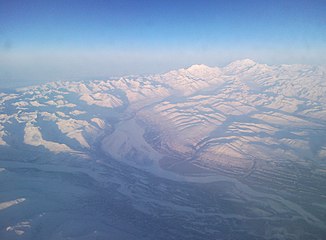
Confluence of the East Fork and West Fork Yentna Rivers (in the lower right corner of the picture) |
||
| Data | ||
| Water code | US : 1412339 | |
| location | Matanuska-Susitna Borough in Alaska (USA) | |
| River system | Susitna River | |
| Drain over | Susitna River → Pacific Ocean | |
| Confluence of |
East Fork and West Fork Yentna Rivers on the southeast flank of the Alaska range 62 ° 16 ′ 50 ″ N , 151 ° 46 ′ 26 ″ W |
|
| Source height | 71 m | |
| muzzle | in the Susitna River coordinates: 61 ° 33 '38 " N , 150 ° 29' 4" W 61 ° 33 '38 " N , 150 ° 29' 4" W. |
|
| Mouth height | 10 m | |
| Height difference | 61 m | |
| Bottom slope | approx. 0.47 ‰ | |
| length | approx. 130 km | |
| Catchment area | approx. 16,000 km² | |
| Discharge A Eo : 15,800 km² Location: 18 km above the mouth |
MQ 1981/1985 Mq 1981/1985 |
575 m³ / s 36.4 l / (s km²) |
| Left tributaries | Lake Creek, Kahiltna River | |
| Right tributaries | Kichatna River , Skwentna River | |
| West Fork Yentna River | ||
| Water code | US : 1411902 | |
| source | 7 km west of Mystic Pass 62 ° 38 ′ 42 ″ N , 152 ° 40 ′ 8 ″ W |
|
| Source height | 1550 m | |
| Association with |
East Fork Yentna River 62 ° 16 ′ 50 " N , 151 ° 46 ′ 26" W.
|
|
| length | approx. 75 km | |
| East Fork Yentna River | ||
| Water code | US : 1401617 | |
| source |
Yentna Glacier 62 ° 37 ′ 35 ″ N , 151 ° 54 ′ 18 ″ W |
|
| Source height | approx. 300 m | |
| Association with |
West Fork Yentna River 62 ° 16 ′ 50 " N , 151 ° 46 ′ 26" W.
|
|
| length | 45 km | |
| Right tributaries | Dall Glacier | |
The Yentna River is an approximately 130 km long right tributary of the Susitna River in the south of the US state Alaska .
The Yentna River arises at the confluence of the West Fork and East Fork Yentna River on the southeast flank of the Alaska Range . It flows in a predominantly south-southeast direction through the lowlands and finally flows into the Susitna River near the village of Susitna . The Yentna River drains an area of approximately 16,000 km². The mean discharge is about 575 m³ / s. Larger tributaries are the Kahiltna River from the left and the Kichatna River and Skwentna River from the right.
The West Fork Yentna River is the right source river of the Yentna River. The 75 km long river has its source in the Alaska range 7 km west of the Mystic Pass . It flows through the mountains initially in a southerly direction and later in an easterly direction. It drains the north side of the Kichatna Mountains .
The East Fork Yentna River is the left headwaters of the Yentna River. The 45 km long river arises at the lower end of the Yentna Glacier . The Dall Glacier ends a few kilometers downstream directly on the river.
