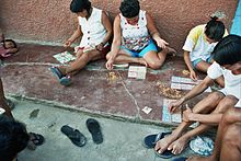
Yurimaguas
Yurimaguas is a city in the Peruvian rainforest . It has 62,903 inhabitants (2017). Yurimaguas is the capital of the Alto Amazonas province in the Loreto region .
Geography and economics
Yurimaguas is located at an altitude of around 150 m on the left bank of the Río Huallaga , a navigable source river of the Amazon in the agricultural area of the Peruvian rainforest. In the west of the city begins a hilly area dominated by farms, which is interspersed with remnants of tropical forest. The Cordillera Oriental with heights up to approx. 2000 m is the last foothill of the Andes in the form of an elongated mountain ridge approx. 70 km southwest of the city. In the east of Yurimaguas, on the right bank of the Río Huallaga, the actual lowlands of the Amazon basin begin .
Yurimaguas can be easily reached by land on a 136 km long, continuously paved road from Tarapoto . Iquitos , the largest city in the Peruvian rainforest, can be reached on the 750 km long river route with barges and passenger ships.
This location makes Yurimaguas an important transhipment point: while goods from the Amazon basin are reloaded here from ships to trucks, products from the coastal region of Peru often come to Iquitos or Brazil via Yurimaguas . Before the Panama Canal was built , many goods were transported from the Atlantic to the Pacific via the Amazon and Yurimaguas.
In addition to the importance of transport, the region's economy is largely agricultural, but tourism is also of increasing importance for the region. In the sparsely populated region, drug cultivation also has a certain share in the economy.
traffic
Buses and shared taxis take passengers to Tarapoto in around 2 to 3 hours.
Combined freight / passenger ships operate to Iquitos. There are no timetables. They drive off when they have enough charge. The travel time is 3 days.
There is an airport with a runway measuring 1800 × 30 m. At the moment there is no public air traffic at Yurimaguas airport. The nearest airport, which is served by numerous airlines several times a day, is Tarapoto.
history
The area in the area of the Río Marañón and Río Huallaga was visited from 1680 by the Jesuit father Samuel Fritz with the aim of evangelizing the indigenous peoples. He founded 38 settlements, so-called Jesuit reductions , including "Nuestra Señora de las Nieves de Yurimaguas", from which the future city of Yurimaguas developed.
On May 26, 2019, several buildings in the city were damaged in a severe earthquake .
Culture

Yurimaguas has a pronounced ethnic and cultural diversity. This is also evident in the number of languages spoken here . In addition to Spanish , languages from three different language families are used here: Quechua , Jibaro and Cahuapana . Around a third of the population is attributed to indigenous population groups.
Yurimaguas is the seat of the Apostolic Vicariate Yurimaguas of the Roman Catholic Church.
climate
The climate in Yurimaguas is tropical , the average annual temperature is 26 ° C. The rainy season is from December to March. During this time the road to Tarapoto is often hardly passable.
| Yurimaguas | ||||||||||||||||||||||||||||||||||||||||||||||||
|---|---|---|---|---|---|---|---|---|---|---|---|---|---|---|---|---|---|---|---|---|---|---|---|---|---|---|---|---|---|---|---|---|---|---|---|---|---|---|---|---|---|---|---|---|---|---|---|---|
| Climate diagram | ||||||||||||||||||||||||||||||||||||||||||||||||
| ||||||||||||||||||||||||||||||||||||||||||||||||
|
Average monthly temperatures and rainfall for Yurimaguas
|
|||||||||||||||||||||||||||||||||||||||||||||||||||||||||||||||||||||||||||
Web links
Individual evidence
- ↑ Instituto Nacional de Estadística e Informática (INEI): Directorio Nacional de Centros Poblados - Censos Nacionales 2017 . Lima 2018, Vol. 4, p. 1392 ( online ).
- ↑ http://www.corpac.gob.pe/Main.asp?T=4130
- ↑ Un fuerte seísmo de magnitud 8 en Perú sacude también Colombia, Venezuela y Ecuador. In: elpais.com . May 26, 2019, accessed May 27, 2019 (Spanish).
Coordinates: 5 ° 54 ′ S , 76 ° 6 ′ W


