Zalaszántó
| Zalaszántó | ||||
|
||||
| Basic data | ||||
|---|---|---|---|---|
| State : | Hungary | |||
| Region : | Western Transdanubia | |||
| County : | Zala | |||
| Small area until December 31, 2012 : | Keszthely | |||
| Coordinates : | 46 ° 53 ' N , 17 ° 14' E | |||
| Area : | 37.73 km² | |||
| Residents : | 1,003 (Jan 1, 2011) | |||
| Population density : | 27 inhabitants per km² | |||
| Telephone code : | (+36) 83 | |||
| Postal code : | 8353 | |||
| KSH kódja: | 33288 | |||
| Structure and administration (status: 2014) | ||||
| Community type : | local community | |||
| Mayor : | Attila Ferenc Dézsi (independent) | |||
| Postal address : | Fő utca 50 8353 Zalaszántó |
|||
| Website : | ||||
| (Source: A Magyar Köztársaság helységnévkönyve 2011. január 1st at Központi statisztikai hivatal ) | ||||
Zalaszántó is a municipality with 1,034 inhabitants in Zala County in Hungary . It is located in western Transdanubia between Hévíz and Sümeg .
history
Zalaszántó was first mentioned in 1236, in the middle of the 16th century the village was besieged by Turks. In the 19th and 20th centuries, the population of Zalaszántós increased significantly; after the Second World War there was a decline in the population. This trend only turned around in the 1990s.
Attractions

Above the community on Mount Kovacs is the Human Rights Park, which contains a Buddhist peace stupa built in 1992 .
Among the attractions of the place which belongs to Roman Catholic Church Szent Kozma és Damján whose first buildings date from the year 1236, the Romanesque chapel Szeplőtelen Fogantatás from 1441 and the chapel Derékhegyi Szent Donát , built 1914th
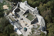
On another mountain near the place are the ruins of Tatika Castle .


