
Balboa Peninsula, Newport Beach: Difference between revisions
Removed duplicate wikilinks from landmark list. Only need to be mentioned once in article. The rest should be made into prose. Copy edit Tags: Mobile edit Mobile web edit Advanced mobile edit |
No edit summary |
||
| (6 intermediate revisions by 4 users not shown) | |||
| Line 1: | Line 1: | ||
{{Short description|Neighborhood of Newport Beach, California}} |
|||
[[Image:Balboa |
[[Image:Balboa Peninsula Photo Don Ramey Logan.jpg|thumb|right|325px|The Balboa Peninsula]] |
||
The '''Balboa Peninsula''' (also referred to as "Balboa" or "the Peninsula") is a neighborhood of the city of [[Newport Beach, California|Newport Beach]], [[Orange County, California]]. It is named after Spanish explorer [[Vasco Núñez de Balboa]], the first European to sight the [[Pacific]] from the Americas.<ref name=Morison1974>{{cite book |
The '''Balboa Peninsula''' (also referred to as "Balboa" or "the Peninsula") is a neighborhood of the city of [[Newport Beach, California|Newport Beach]], [[Orange County, California]]. It is named after Spanish explorer [[Vasco Núñez de Balboa]], the first European to sight the [[Pacific]] from the Americas.<ref name=Morison1974>{{cite book |
||
| last = Morison |
| last = Morison |
||
| Line 14: | Line 15: | ||
==History== |
==History== |
||
{{Main|History of Newport Beach}} |
{{Main|History of Newport Beach}} |
||
In 1888, the McFadden family, which had arrived in California c. 1849, decided their shipping business would be more successful if they moved it from the inner shores of the bay to the oceanfront, where it was connected by rail to Santa Ana.<ref name="balboa-island.net">Balboa Island Visitor's Guide, www.balboa-island.net, 2002.</ref> They built [[McFadden Wharf]] at the location where the [[Newport Pier]] is today. In 1899, the Federal Government allocated funds for major improvements to a new harbor at San Pedro, which would become Southern California's major seaport. The McFadden Wharf and railroad were sold to the Southern Pacific Railroad that same year, signaling the end of Newport Bay as a commercial shipping center.<ref name="balboa-island.net"/> |
In 1888, the McFadden family, which had arrived in California c. 1849, decided their shipping business would be more successful if they moved it from the inner shores of the bay to the oceanfront, where it was connected by rail to [[Santa Ana, California|Santa Ana]].<ref name="balboa-island.net">Balboa Island Visitor's Guide, www.balboa-island.net, 2002.</ref> They built [[McFadden Wharf]] at the location where the [[Newport Pier]] is today. In 1899, the Federal Government allocated funds for major improvements to a new harbor at San Pedro, which would become Southern California's major seaport. The McFadden Wharf and railroad were sold to the Southern Pacific Railroad that same year, signaling the end of Newport Bay as a commercial shipping center.<ref name="balboa-island.net"/> |
||
[[File:Harbor front Home Newport Beach California.jpg|thumb|Harborfront home, Newport Beach]] |
[[File:Harbor front Home Newport Beach California.jpg|thumb|Harborfront home, Newport Beach]] |
||
In 1902, James McFadden sold his Newport townsite and about half of the peninsula to William Collins, who saw Newport Bay's resort and recreation potential. Collins took on [[Henry E. Huntington]] as a partner in the Newport Beach Company. Huntington had acquired the [[Pacific Electric]] railway system and used it to promote new communities outside of [[Los Angeles]].<ref name="balboa-island.net"/> |
In 1902, James McFadden sold his Newport townsite and about half of the peninsula to William Collins, who saw Newport Bay's resort and recreation potential. Collins took on [[Henry E. Huntington]] as a partner in the Newport Beach Company. Huntington had acquired the [[Pacific Electric]] railway system and used it to promote new communities outside of [[Los Angeles]].<ref name="balboa-island.net"/> |
||
In 1905, the Pacific Electric [[Balboa Line]] was extended to Newport. Collins began dredging a channel on the north side of the bay and deposited the sand and silt on tidelands that would become Balboa Island. Newport Harbor was still largely undredged |
In 1905, the Pacific Electric [[Balboa Line]] was extended to Newport. Collins began dredging a channel on the north side of the bay and deposited the sand and silt on tidelands that would become Balboa Island. Newport Harbor was still largely undredged. |
||
==Boundaries== |
==Boundaries== |
||
The peninsula acts as a jetty enclosing the Newport Harbor and Newport Beach's |
The peninsula acts as a jetty enclosing the Newport Harbor and Newport Beach's eight islands. The Peninsula is connected from the land via [[California State Highway 1|Pacific Coast Highway (SR 1)]] at Balboa Boulevard, via Bridge at Newport Boulevard ([[California State Route 55|SR 55]]) from SR 1 (and from Via Lido which connects via bridge to Lido Isle, via Bridge from Newport Island, via Bridge from Bay Isle and via [[Balboa Island Ferry]] from Balboa Boulevard and Palm Street to Balboa Island which is connected via bridge from [[Jamboree Road]] and SR 1. The west end of Balboa Island connects via bridge to Collins Isle and the east end connects via bridge over the Grand Canal to the Little Island. The center of the Peninsula is called Balboa Village and the end of the Peninsula is called Balboa Peninsula Point.<ref>{{Cite news|last=Wisckol|first=Martin|date=2020-06-11|title=Coastal Commission approves $1.7 million in fines for illegal beach yards in Newport Beach|url=https://www.ocregister.com/coastal-commission-approves-1-7-million-in-fines-for-illegal-beach-yards-in-newport-beach|access-date=2020-06-14|newspaper=[[Orange County Register]]|language=en-US}}</ref><ref>{{Cite news|last=Wisckol|first=Martin|date=2020-06-03|title=California homeowners fined $1.7 million for illegal yards on beach|url=https://www.ocregister.com/newport-beach-homeowners-fined-1-7-million-for-illegal-yards-on-beach|access-date=2020-06-05|website=The Mercury News|language=en-US}}</ref><ref>{{Cite news|url=https://www.latimes.com/socal/daily-pilot/news/story/2020-02-19/coastal-commission-prepares-to-order-removal-of-unpermitted-beach-encroachments-in-newport|title=Coastal Commission prepares to order removal of unpermitted beach encroachments in Newport|last=Davis|first=Hillary|date=2020-02-19|work=Daily Pilot|publisher=[[Los Angeles Times]]|language=en-US|access-date=2020-02-21}}</ref> Balboa Pier is near the Balboa Island Ferry in Balboa Village and about two miles toward SR 1 is Newport Pier at McFadden Square. Linda Isle and Harbor Island connect via bridge from Bayside Drive off SR 1. |
||
==Landmarks== |
==Landmarks== |
||
| Line 41: | Line 42: | ||
<gallery> |
<gallery> |
||
File:Newport Beach california 5 march 9 2014 photo d ramey logan.jpg|Balboa Peninsula |
|||
File:Newport Beach harbor california 6 march 9 2014 photo d ramey logan.jpg|Balboa Peninsula |
|||
File:Balboa Peninsula Ferry Terminal 01.jpg|Balboa Island Ferry Terminal on Balboa Peninsula |
|||
File:Balboa Peninsula Ferry Terminal 02.jpg|Balboa Island Ferry Terminal on Balboa Peninsula |
|||
File:Wedge Newport Hurricane Marie photo D Ramey Logan.jpg|The Wedge: a popular destination for [[skimboarding]], [[surfing]], [[bodyboarding]] and [[bodysurfing]] is at the end of the Balboa Peninsula, Newport Beach |
File:Wedge Newport Hurricane Marie photo D Ramey Logan.jpg|The Wedge: a popular destination for [[skimboarding]], [[surfing]], [[bodyboarding]] and [[bodysurfing]] is at the end of the Balboa Peninsula, Newport Beach. |
||
File:Newport Harbor Sunset Photo D Ramey Logan.jpg|Newport Harbor Sunset |
File:Newport Harbor Sunset Photo D Ramey Logan.jpg|Newport Harbor Sunset |
||
File:Balboa Pier, Newport.JPG|Balboa Pier |
File:Balboa Pier, Newport.JPG|Balboa Pier |
||
</gallery> |
</gallery> |
||
| Line 59: | Line 60: | ||
{{coord|33|36|10|N|117|54|15|W|type:city_region:US-CA|display=title}} |
{{coord|33|36|10|N|117|54|15|W|type:city_region:US-CA|display=title}} |
||
{{Newport Beach, California}} |
|||
[[Category:Balboa Peninsula| ]] |
[[Category:Balboa Peninsula| ]] |
||
Latest revision as of 00:48, 4 January 2024

The Balboa Peninsula (also referred to as "Balboa" or "the Peninsula") is a neighborhood of the city of Newport Beach, Orange County, California. It is named after Spanish explorer Vasco Núñez de Balboa, the first European to sight the Pacific from the Americas.[1] Balboa is primarily residential with some commercial areas.
History[edit]
In 1888, the McFadden family, which had arrived in California c. 1849, decided their shipping business would be more successful if they moved it from the inner shores of the bay to the oceanfront, where it was connected by rail to Santa Ana.[2] They built McFadden Wharf at the location where the Newport Pier is today. In 1899, the Federal Government allocated funds for major improvements to a new harbor at San Pedro, which would become Southern California's major seaport. The McFadden Wharf and railroad were sold to the Southern Pacific Railroad that same year, signaling the end of Newport Bay as a commercial shipping center.[2]

In 1902, James McFadden sold his Newport townsite and about half of the peninsula to William Collins, who saw Newport Bay's resort and recreation potential. Collins took on Henry E. Huntington as a partner in the Newport Beach Company. Huntington had acquired the Pacific Electric railway system and used it to promote new communities outside of Los Angeles.[2]
In 1905, the Pacific Electric Balboa Line was extended to Newport. Collins began dredging a channel on the north side of the bay and deposited the sand and silt on tidelands that would become Balboa Island. Newport Harbor was still largely undredged.
Boundaries[edit]
The peninsula acts as a jetty enclosing the Newport Harbor and Newport Beach's eight islands. The Peninsula is connected from the land via Pacific Coast Highway (SR 1) at Balboa Boulevard, via Bridge at Newport Boulevard (SR 55) from SR 1 (and from Via Lido which connects via bridge to Lido Isle, via Bridge from Newport Island, via Bridge from Bay Isle and via Balboa Island Ferry from Balboa Boulevard and Palm Street to Balboa Island which is connected via bridge from Jamboree Road and SR 1. The west end of Balboa Island connects via bridge to Collins Isle and the east end connects via bridge over the Grand Canal to the Little Island. The center of the Peninsula is called Balboa Village and the end of the Peninsula is called Balboa Peninsula Point.[3][4][5] Balboa Pier is near the Balboa Island Ferry in Balboa Village and about two miles toward SR 1 is Newport Pier at McFadden Square. Linda Isle and Harbor Island connect via bridge from Bayside Drive off SR 1.
Landmarks[edit]

- Balboa Pavilion (established 1906)
- Balboa Theater (established 1928)
- Balboa Inn (established 1929)[6]
- Balboa Fun Zone
- Balboa Island Ferry
- Balboa Pavilion
- Balboa Pier
- The Crab Cooker
- Dory Fishing Fleet
- Lovell Beach House
- Newport Elementary School
- The Wedge
Gallery[edit]
-
 Balboa Peninsula
 -
 Balboa Peninsula
 -
 Balboa Island Ferry Terminal on Balboa Peninsula
 -
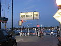 Balboa Island Ferry Terminal on Balboa Peninsula
 -
 The Wedge: a popular destination for skimboarding, surfing, bodyboarding and bodysurfing is at the end of the Balboa Peninsula, Newport Beach.
 -
 Newport Harbor Sunset
 -
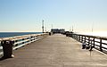 Balboa Pier


References[edit]
- ^ Morison, Samuel (1974). The European Discovery of America: The Southern Voyages, 1492-1616. New York: Oxford University Press.
- ^ a b c Balboa Island Visitor's Guide, www.balboa-island.net, 2002.
- ^ Wisckol, Martin (2020-06-11). "Coastal Commission approves $1.7 million in fines for illegal beach yards in Newport Beach". Orange County Register. Retrieved 2020-06-14.
- ^ Wisckol, Martin (2020-06-03). "California homeowners fined $1.7 million for illegal yards on beach". The Mercury News. Retrieved 2020-06-05.
- ^ Davis, Hillary (2020-02-19). "Coastal Commission prepares to order removal of unpermitted beach encroachments in Newport". Daily Pilot. Los Angeles Times. Retrieved 2020-02-21.
- ^ "National Register of Historic Places".