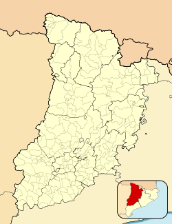
Vinaixa
Vinaixa | |
|---|---|
 Fireworks outside the church of St. John the Baptist | |
| Coordinates: 41°25′49″N 0°58′34″E / 41.43028°N 0.97611°E | |
| Country | |
| Community | |
| Province | Lleida |
| Comarca | Les Garrigues |
| Government | |
| • Mayor | Josep Maria Tarragó Clivillé (2019)[1] |
| Area | |
| • Total | 37.6 km2 (14.5 sq mi) |
| Elevation | 479 m (1,572 ft) |
| Population (2018)[3] | |
| • Total | 482 |
| • Density | 13/km2 (33/sq mi) |
| Demonym | Vinaixenc |
| Postal code | 25440 |
| Website | vinaixa |
Vinaixa (pronounced [biˈnaʃə]) is a municipality in the region of Les Garrigues, in the province of Lleida, Catalonia, Spain.
The town center is arranged around the old castle and in the appearance of the buildings the stone predominates. It has a hunting ground and the stone industry has been the main economic activity for many years. In its municipality there are numerous pine forests.
The main attraction is the church of St. John the Baptist, in Romanesque-Cistercian style. It houses several Romanesque paintings and Gothic retable.
Geography
Vinaixa is a municipality located in the south-eastern sector of the region of Les Garrigues, in a high area, on the border with the Conca de Barberà, and in the line of historical communications of the coast with the interior. The term has an area of 37.60 square kilometres and extends in the shape of a rectangle. It borders Vimbodí i Poblet (SE), Vallclara (S), El Vilosell (SW), L'Albi (W), Les Borges Blanques and La Floresta (NW), Els Omellons (N), L'Espluga Calba (NE), Fulleda and Tarrés (E). The population centre is in the southern half of the term, to 480.90 meters on the level of the sea.
It can be accessed by the N-240 road and also by the AP-2 motorway, with an exit at L'Albi (exit 8: L'Albi - Vinaixa). It has connections, through local roads and fixed roads, with neighbouring villages. There is a railway station (Lleida - Barcelona | Barcelona - Lleida) and a bus stop (Lleida - Tarragona | Tarragona - Lleida).
The municipality is based on the land of Oligocene origin. Several mountain ranges cross the term from north to south (Serra dels Barrils, Serra Mitjana, Serra de les Solanes), which facilitate the existence of depressions (Fondo dels Barrils, Fondo de Coma Timons, Fondo Major, Fondo de les Sivines). The highest points of the term are Punta del Puig (570 meters), to the north, and Punta dels Ràfols (675 meters), to the east.
The climate is the continental Mediterranean, typical of the Ebro Depression.[4]
References
- ^ "Ajuntament de Vinaixa". Generalitat of Catalonia. Retrieved 2015-11-13.
- ^ "El municipi en xifres: Vinaixa". Statistical Institute of Catalonia. Retrieved 2015-11-23.
- ^ Municipal Register of Spain 2018. National Statistics Institute.
- ^ Abelló i Güell, Teresa (2010). Vinaixa: passat i present (in Catalan). Vinaixa; Lleida: Ajuntament de Vinaixa; Institut d'Estudis Ilerdencs. ISBN 978-84-96908-62-8.
External links
- Government data pages (in Catalan)


