Limoeiro: Difference between revisions
Content deleted Content added
+seal |
|||
| (4 intermediate revisions by 4 users not shown) | |||
| Line 46: | Line 46: | ||
<!-- population ----------------> |
<!-- population ----------------> |
||
| population_footnotes = |
| population_footnotes = |
||
| population_total = |
| population_total = 56,198 |
||
| population_as_of = |
| population_as_of = 2020 <ref>[https://cidades.ibge.gov.br/brasil/pe/limoeiro/panorama IBGE 2020]</ref> |
||
| population_density_km2 = <!-- for automatic calculation of any density field, use: auto --> |
| population_density_km2 = <!-- for automatic calculation of any density field, use: auto --> |
||
<!-- time zone(s) --------------> |
<!-- time zone(s) --------------> |
||
| timezone1 = |
| timezone1 = [[Time in Brazil|BRT]] |
||
| utc_offset1 = |
| utc_offset1 = −3 |
||
| timezone1_DST = |
| timezone1_DST = |
||
| utc_offset1_DST = |
| utc_offset1_DST = |
||
| Line 74: | Line 74: | ||
* Area - 269.97 km<sup>2</sup> |
* Area - 269.97 km<sup>2</sup> |
||
* Elevation - 138 m |
* Elevation - 138 m |
||
* |
* Hydrography - [[Capibaribe River|Capibaribe]] and Goiana rivers |
||
* Vegetation - [[Caducifólia]] forest |
* Vegetation - [[Caducifólia]] forest |
||
* |
* Climate - hot, tropical, and humid |
||
* Annual average temperature - 25.1 c |
* Annual average temperature - 25.1 c |
||
* Distance to [[Recife]] - 91 km |
* Distance to [[Recife]] - 91 km |
||
| Line 82: | Line 82: | ||
==Economy== |
==Economy== |
||
The main economic activities in Limoeiro are based in industry, commerce, tourism and [[agribusiness]] |
The main economic activities in Limoeiro are based in industry, commerce, tourism and [[agribusiness]]; especially plantations of [[banana]]s and [[sugarcane]], and the raising of [[cattle]], [[goat]]s, [[sheep]], [[pig]]s and [[chicken]]s. |
||
===Economic indicators=== |
===Economic indicators=== |
||
| Line 134: | Line 134: | ||
{{Municipalities of Pernambuco}} |
{{Municipalities of Pernambuco}} |
||
[[Category:Municipalities in Pernambuco]] |
[[Category:Municipalities in Pernambuco]] |
||
{{Pernambuco-geo-stub}} |
{{Pernambuco-geo-stub}} |
||
Latest revision as of 05:30, 19 June 2022
Limoeiro | |
|---|---|
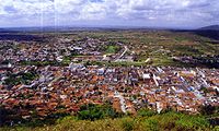
 Limoeiro Overview | |
| Coordinates: 7°52′30″S 35°27′00″W / 7.87500001°S 35.45000001°W | |
| Country | |
| State | Pernambuco |
| Region | Agreste |
| Area | |
| • Total | 269.97 km2 (104.24 sq mi) |
| Elevation | 138 m (453 ft) |
| Population (2020 [1]) | |
| • Total | 56,198 |
| Time zone | UTC−3 (BRT) |
| Average Temperature | 25.1 °C (77.2 °F) |

Limoeiro is a city in Pernambuco, Brazil.
Geography[edit]
- State - Pernambuco
- Region - Agreste Pernambucano
- Boundaries - Vicência (N); Passira and Feira Nova (S); Carpina, Lagoa do Carro and Buenos Aires (E); Bom Jardim, Salgadinho and João Alfredo (W)
- Area - 269.97 km2
- Elevation - 138 m
- Hydrography - Capibaribe and Goiana rivers
- Vegetation - Caducifólia forest
- Climate - hot, tropical, and humid
- Annual average temperature - 25.1 c
- Distance to Recife - 91 km
Economy[edit]
The main economic activities in Limoeiro are based in industry, commerce, tourism and agribusiness; especially plantations of bananas and sugarcane, and the raising of cattle, goats, sheep, pigs and chickens.
Economic indicators[edit]
| Population[2] | GDP x(1000 R$).[3] | GDP pc (R$) | PE |
|---|---|---|---|
| 57.243 | 219.496 | 3.951 | 0.37% |
Economy by sector (2006)
| Primary sector | Secondary sector | Service sector |
|---|---|---|
| 5.76% | 12.32% | 81.92% |
Health indicators[edit]
| HDI (2000) | Hospitals (2007) | Hospitals beds (2007) | Children's mortality every 1000 (2005) |
|---|---|---|---|
| 0.688 | 2 | 141 | 17.2 |
References[edit]
- ^ IBGE 2020
- ^ http://www.ibge.gov.br/home/estatistica/populacao/estimativa2009/POP2009_DOU.pdf IBGE Population 2009 (Limoeiro, page 33)
- ^ Limoeiro 2007 GDP IBGE page 30 Archived 2016-03-04 at the Wayback Machine
- ^ PE State site - City by city profile
External links[edit]
 Media related to Limoeiro (Pernambuco) at Wikimedia Commons


