Nosálov: Difference between revisions
Content deleted Content added
Cote d'Azur (talk | contribs) |
m →References: add authority control |
||
| Line 92: | Line 92: | ||
{{coord|50|28|N|14|40|E|display=title|region:CZ_type:city_source:GNS-enwiki}} |
{{coord|50|28|N|14|40|E|display=title|region:CZ_type:city_source:GNS-enwiki}} |
||
{{authority control}} |
|||
{{DEFAULTSORT:Nosalov}} |
{{DEFAULTSORT:Nosalov}} |
||
Revision as of 02:28, 1 April 2020
You can help expand this article with text translated from the corresponding article in Czech. (July 2009) Click [show] for important translation instructions.
|
Nosálov
Nosadl | |
|---|---|
Municipality and village | |
 | |
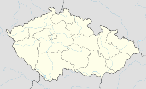
| Coordinates: 50°28′26″N 14°41′10″E / 50.47389°N 14.68611°E | |
| Country | |
| Region | Central Bohemian Region |
| District | Mělník District |
| Government | |
| • Mayor | Lenka Střihavková |
| Area | |
| • Total | 4.3 sq mi (11.1 km2) |
| Elevation | 1,263 ft (385 m) |
| Population (2011) | |
| • Total | 165 |
| • Density | 38/sq mi (15/km2) |
| Time zone | UTC+1 (CET) |
| • Summer (DST) | UTC+2 (CEST) |
| Postal Code | 277 35-277 36 |
| Website | www.noslaov.cz |
Nosálov is a village and municipality in Mělník District in the Central Bohemian Region of the Czech Republic.
History
The first written mention of the village comes from the 1324.
Sightseeing
- Chapel of the Holy Trinity in the southeastern part of the village
- Sellnerovo fort, archaeological site
References
- This article was initially translated from the Czech Wikipedia.
Wikimedia Commons has media related to Nosálov.
50°28′N 14°40′E / 50.467°N 14.667°E


