
Ahja (river)
| Ah yes | ||
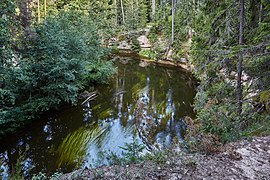
 Ahja at Väike-Taevaskoda |
||
| Data | ||
| location | Estonia | |
| River system | Narva | |
| Drain over | Emajõgi → Narva → Baltic Sea | |
| origin | Lake Erastvere on the Otepää ridge 57 ° 58 ′ 53 ″ N , 26 ° 47 ′ 26 ″ E |
|
| muzzle | in the Emajõgi coordinates: 58 ° 23 '23 " N , 27 ° 9' 23" E 58 ° 23 '23 " N , 27 ° 9' 23" E |
|
| Height difference | 87.6 m | |
| Bottom slope | 0.92 ‰ | |
| length | 95 km | |
| Catchment area | 1073 km² | |
| Left tributaries | Hilba , Leevi | |
| Right tributaries | Lutsu , Orajõgi | |
| Reservoirs flowed through | Saesaare hydroelectric power station | |
| Navigable | Lower course | |
 Canoeing on the Ahja River in Põlvamaa County |
||
The Ahja ( Estonian Ahja jõgi ; German name: Aya ) is a river in southeast Estonia .
course
The river begins at Lake Erastvere (16.3 hectares) on the Otepää ridge . It flows into the Emajõgi ( German Embach ) after 95 kilometers , about 8.8 km before it flows into the Peipussee . The river covers a gradient of 87.6 m. Its catchment area covers 1073 km².
The right tributaries of the Ahja are Lutsu and Orajõgi , the left tributaries Hilba and Leevi .
geography
The Ahja is navigable on the lower reaches. The Saesaare hydroelectric power station was built around halfway in 1951. On the upper reaches of the river is the landscape protection area of Tilleoru (1.9 km², location ). The protected landscape area of the Ahja glacial valley (10.4 km²) is located between the villages of Koorvere and Valgesoo over a distance of 18 km .
Ecosystem
The Ahja is one of the most fish and species-rich rivers in Estonia (especially brown trout , rainbow trout , grayling , pike , roach , chub , hazel , minnow , rudd , gudgeon , bleak , tailor , bream , burbot , nine-spined stickleback and ruff ). 34 different plant species were detected.
Väike Taevaskoda (2013)
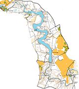
Map section
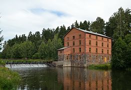
Watermill at Kiidjärve

Ahja in winter


Web links
Individual evidence
- ↑ Ahja jõe ürgoru maastikukaitseala. (PDF) 2010, accessed June 29, 2015 (Estonian, images and map of the protected landscape area).