Altmann (mountain)
| Altmann | |
|---|---|
|
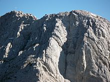
View from the Schafberg to the Altmann (south side), |
|
| height | 2435 m above sea level M. |
| location |
Canton border AI / SG , CH |
| Mountains | Appenzell Alps |
| Dominance | 2.3 km → Säntis |
| Notch height | 315 m ↓ Rotsteinpass |
| Coordinates | 746 370 / 233892 |
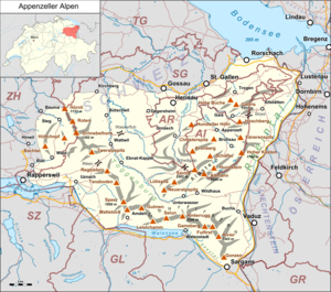
The Altmann (emphasis on the second syllable) is at 2435 m above sea level. M. the second highest mountain of the Alpstein and the Appenzell Alps as a whole on the border of the cantons of Appenzell Innerrhoden (district of Rüte ) and St. Gallen (community of Wildhaus-Alt St. Johann ) in Switzerland . It is made of limestone .
The name Altmann comes from the Romanesque Altus Mons , which means high mountain and developed over time via Altmon to Altmann.
Ascent
Carl Friedrich Fröhlich, Huber & Looser were named as the first to climb in July 1825. The mountain may have been climbed earlier as part of hunting and herding .
The Altmann can be reached from the higher Säntis via Lisengrat and Rotsteinpass . Likewise from the Zwinglipass. Both paths meet at the end of the Nädligergrat above the Flis-Schafbodenwand, from where a mountain hiking trail to Altmannsattel - according to the Swiss national map Altmasattel 2367 m above sea level. M. - leads. Another path climbs up from the Fählensee . The ascent to the summit requires easy climbing in the second degree , which is made easier by iron pins in tricky places. Because of the greasy rocks, caution is required and the transition over the ridge to the summit cross (with summit book ) is exposed and requires climbing a notch.
The Altmann is a classic climbing mountain. The first climbing routes led through the canyon-like chimneys in the south wall, later the west and east ridge were destinations for first-time climbers. In the 1980s there were numerous first ascents, up to the eighth grade , through the south face.
view
The free view is terrific thanks to the exposed and unspoilt location (as opposed to Säntisgipfel with different structures). Only the Säntis, around 70 meters higher, interrupts the unobstructed panoramic view in the northwest . From Altmann summit of the mountain by is Lake Constance on the Appenzell region to the Rhine Valley and the Allgäu Alps and the Bregenz Forest to the east towards Verwall , Rätikon , Silvretta Group , the Grisons and Glarus Alps and to the west with the Bernese Alps , the Rigi and Lake Zurich to see. The panorama shows vast landscapes in Germany, Austria, Liechtenstein and Eastern Switzerland.
nature
Ibex and ptarmigan can be found in the Altmann area .
Web links
- Interactive spherical panorama from the summit of the Altmann
- Altmann (Berg) on the ETHorama platform
Individual evidence
- ↑ a b c SwissTopo with hiking trails
- ^ A b Ernst Höhne: Knaur's Lexicon for Mountain Friends / The Alps between Matterhorn and Lake Constance . Droemer Knaur, Munich 1987, ISBN 3-426-26223-1 , p. 25 .
- ↑ SAC climbing guide from 2001


