
Angelhofer Altrhein


The Angelhofer Altrhein is an oxbow lake on the west side of the Rhine between Speyer and Otterstadt in the German state Rhineland-Palatinate . Before the straightening of the Rhine by Johann Gottfried Tulla, the loop was the main course of the Rhine and only became an oxbow river through the Angelhof intersection (see map from 1826).
Surname
The name of the old Rhine arm and the peninsula formed by it, between the old Rhine arm and the Rhine with the fishing forest, comes from an abandoned farm called Angelhof (see map from 1826). Later there were two properties, Angelhof I and Angelhof II , directly on the Rheinstrom. Angelhof I was demolished, Angelhof II is used as a bar at times.
Location and description
The oxbow lake is located north of the federal motorway 61 at the point where it crosses the Rhine by means of the Rhine bridge Speyer . While the southern end of this Rhine bend was separated from the Rhine by an embankment, the Angelhofer Altrhein is connected to the main Rhine at its northern end at Rhine kilometer 406.2.
The area on the west bank of the Angelhofer Altrhein is known as Im Reffenthal or Reffenthal for short . From time to time the misnomer Reffenthaler Altrhein is used for the Altrheinarm. The arched shape of the Angelhofer Altrhein makes this strip narrower and the Reffenthal water training area, which belonged to the 464 Special Pioneer Battalion, follows the alluvial forest . The southern part of the pioneer facility used to belong to the French army and was known as the “Quartier Riberpray”, while the northern part belonged to the German pioneers.
In the south-east of the island there are two small interconnected lakes, where campsites used to be located. These were evacuated. In the north, a lake was cut from the arm of the Rhine into the island by gravel dredging, expanding the arm of the old Rhine. The north-west of the Angelhofer Altrhein was also expanded through gravel dredging. There are sunbathing areas for yachts. In the west, the area is bounded by the main Rhine dike, on which District Road 2 initially runs in a north-south direction between Speyer and Otterstadt . Seen from the A 61 on the area between the Rhine and Rheinhauptdeich there is a piece of alluvial forest to the east and a large river valley meadow to the west . The area west of the main Rhine dike and south of the K 2 to the Hochgestade is part of the Rhine lowlands and is called Binsfeld . Its center is a group of 8 quarry ponds.
At the northern end of the barracks, Kreisstraße 2 leaves the main Rhine dike and swings west towards Otterstadt, making a gentle curve. This curve corresponds there to the earlier course of the silted up former old Rhine arm Speyerlache. To the north of the barracks there is a public slipway that can be used to launch boats. The system is sufficient for eight-meter boats.
Further north follows the Reffenthal campsite with 12 hectares of land and then the yacht club area in the north-east, and finally alluvial forest in the north-west. The Reffenthal campsite was created through wild camping on the grounds of the Erlus -Werke Speyer. These campers founded the Campingfreunde Reffenthal association in 1971, which also operates five piers. The first yacht club was built in 1965 on the premises of the Speyer brickworks by the 1st MBC Speyer. The clubhouse, the "Rheinschnook", is a 13-ton wooden ship built in 1911. The sailing club Speyer, the Segler-Vereinigung Mannheim eV and the yacht club Otterstadt im Angelwald eV each operate a further jetty

View to the south of the middle area of the old Rhine arm and the water limit of the military restricted area.
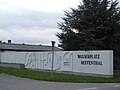
Reffenthal water exercise area, formerly the Riberpray district

View from the slipway to the fishing forest opposite.

View of the southern beginning of the reed belt

middle area of the reed belt

in the northern area of the Old Rhine; View to the east of the fishing forest

in the northwest area of the Bogen: the Rheinschnook - the club house of the 1st MBC Speyer

the boat launch in the north

View from the Rhine dam on the camping car

old little caravan

Solar barrel for showering

View from the Rheindamm, which closes the area, towards Otterstadt


nature
Bird sanctuary
The area is part of the EU bird sanctuary 6616-401 "Otterstadter- und Angelhofer Altrhein including Binsfeld". There are breeding occurrences of black kite , kingfisher and middle woodpecker as well as ancillary occurrences of bluethroat , gray woodpecker and black woodpecker . As migratory birds come before diving ducks , divers , cormorants , white-fronted goose , gray goose , bean goose , barnacle goose and seagulls .
Fauna-flora habitat
The Angelhofer Altrhein is also part of the nature reserve according to NATURA 2000: FFH area 6616-304 "Rheinniederung Speyer-Ludwigshafen".
In the waters find the protected fish species river lamprey , sea lamprey , salmon , loach , shad and bitterling and shellfish species Common river mussel . Of rare insects that find bugs hero Bock and stag beetles and butterflies Black Blue Moorbläuling and Spanish flag . The following rare and protected habitats can be found in the area:
- Code 3150 Eutrophic still waters: in the lake-like extension of the Angelhofer Altrhein in the northeast
- Code 3270 Muddy river banks: in front of the soft wood floodplains of the islands and in the extended part of the northeast Angelhofer Altrhein
- Code 91E0 Softwood floodplain forest: north bank near the estuary, islands, peninsulas, east and north-east bank north of the fishing forest, in the southern part alongside the bank, often only band-shaped
- Code 91F0 Oak-elm-ash floodplain forests on the banks of large rivers: Large areas with old trees northwest of the mouth of the Old Rhine into the Rhine, small areas in the fishing forest and on the island in the southern part.
See also
- In the south of Speyer the Speyer floodplain forest
- In addition to the water training area in Angelhofer Altrhein, the soldiers of the Kurpfalzkaserne also have access to the Speyer site training area in the Dudenhofen forest, a part of the Speyer forest .
Web links
- Location and surroundings of the Angelhofer Altrhein on: State Institute for the Environment Baden-Württemberg (LUBW) ( information )
- Water quality at the Angelhofer Altrhein measuring point, campsite
- Overview map and some pictures of the area ( Memento from August 8, 2013 in the Internet Archive )
Individual evidence
- ↑ z. B. on wassersport-pool.info ( Memento from July 15, 2014 in the Internet Archive )
- ↑ Rhine ( Memento from July 15, 2014 in the Internet Archive )
- ↑ Entry RLP Citizen Service
- ↑ campers VCR Reffenthal
- ↑ Construction in Reffenthal: Origin of the "Paradise" ( Memento from December 5, 2010 in the Internet Archive )
- ↑ The Rheinschnook goes to Reffenthal ( Memento of 10 December 2010 at the Internet Archive )
- ↑ Welcome to the sailing club Speyer
- ↑ Reffenthal - sailors - Association Mannheim
- ↑ Yacht-Club Otterstadt im Angelwald eV Accessed April 10, 2018 .
- ↑ Michael Höllgärtner: Compatibility assessment according to § 34 and 35 BNatSchG for the Reffenthal building project and use of the Angelhofer Altrhein by the Speyer Rowing Society , pages 16-17 (presented to the 15th meeting of the Speyer building and planning committee, October 26, 2011)
- ↑ Michael Höllgärtner: Compatibility assessment according to § 34 and 35 BNatSchG for the Reffenthal building project and use of the Angelhofer Altrhein by the Speyer Rowing Society , page 15 (presented to the 15th meeting of the Speyer City Building and Planning Committee, October 26, 2011)
- ↑ Michael Höllgärtner: Compatibility assessment according to § 34 and 35 BNatSchG for the Reffenthal building project and use of the Angelhofer Altrhein by the Speyer Rowing Society , page 21 (presented to the 15th meeting of the Speyer City Building and Planning Committee, October 26, 2011)
Coordinates: 49 ° 20 ′ 55 " N , 8 ° 28 ′ 50.7" E