Arconce
| Arconce | ||
|
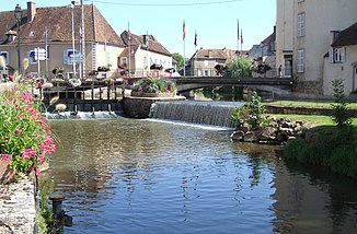
The Arconce in Charolles |
||
| Data | ||
| Water code | FR : K11-0320 | |
| location | France , Bourgogne-Franche-Comte region | |
| River system | Loire | |
| Drain over | Loire → Atlantic Ocean | |
| source | on the parish of Mary and Gourdon, 46 ° 36 ′ 34 ″ N , 4 ° 28 ′ 22 ″ E |
|
| Source height | approx. 458 m | |
| muzzle | in the municipality of Varenne-Saint-Germain in the Loire Coordinates: 46 ° 26 ′ 39 ″ N , 4 ° 0 ′ 17 ″ E 46 ° 26 ′ 39 ″ N , 4 ° 0 ′ 17 ″ E |
|
| Mouth height | approx. 229 m | |
| Height difference | approx. 229 m | |
| Bottom slope | approx. 2.3 ‰ | |
| length | 99 km | |
| Left tributaries | Ozolets | |
| Reservoirs flowed through | Étang du Rousset | |
The Arconce is a river in France that runs in the Saône-et-Loire department , in the Bourgogne-Franche-Comté region . It rises on the municipal boundary of Mary and Gourdon , about 7 kilometers southeast of Montceau-les-Mines . The Arconce drains a good three quarters of its course towards the southwest, through the landscapes of the Charolais and the Brionnais , then suddenly turns north at Anzy-le-Duc and flows into the Loire after 99 kilometers in the municipality of Varenne-Saint-Germain as a right tributary .
Places on the river
- Marizy
- Viry
- Charolles
- Saint-Didier-en-Brionnais
- Anzy-le-Duc
- Montceaux-l'Étoile
- Saint-Yan
- Varenne-Saint-Germain
Web links
Commons : Arconce - collection of images, videos and audio files
