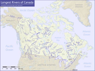
Back River (Chantrey Inlet)
|
Back River Thleendungodyeth, Haningayok, Great Fish River |
||
| Data | ||
| location | Northwest Territories , Nunavut ( Canada ) | |
| River system | Back River | |
| source | north of Aylmer Lake 64 ° 29 ′ 11 ″ N , 108 ° 13 ′ 54 ″ W |
|
| Source height | 382 m | |
| muzzle | to Chantrey Inlet Bay (Arctic Ocean) Coordinates: 67 ° 16 ′ 11 " N , 95 ° 15 ′ 41" W 67 ° 16 ′ 11 " N , 95 ° 15 ′ 41" W |
|
| Mouth height | 0 m | |
| Height difference | 382 m | |
| Bottom slope | 0.39 ‰ | |
| length | 974 km | |
| Catchment area | 106,500 km² | |
| Discharge at the gauge below Beechey Lake A Eo : 19,600 km² |
MQ 1978/2000 Mq 1978/2000 |
109 m³ / s 5.6 l / (s km²) |
| Discharge at the gauge above Hermann River A Eo : 93,900 km² |
MQ 1965/2000 Mq 1965/2000 |
481 m³ / s 5.1 l / (s km²) |
| Left tributaries | Icy River | |
| Right tributaries | Hayes River | |
| Flowing lakes | Beechey Lake , Pelly Lake , Upper Garry Lake , Garry Lake , Lower Garry Lake , Upper Macdougall Lake , Lower Macdougall Lake | |
Back River ( Dogrib : Thleendungodyeth or Thlew-ee-choh-desseth - "Great Fish River", Inuktitut : Haningayok ) is a river in the Canadian territory of Nunavut and in the Canadian Northwest Territories .
The river has its source north of Aylmer Lake and flows after a flow path of more than 900 km northeast into a bay of the Arctic Ocean , the Chantrey Inlet in the south of King William Island and Gjoa Haven . Due to the numerous rapids, it can only be used by experienced canoeists . It flows through u. a. the following lakes: Beechey Lake , Pelly Lake , Upper Garry Lake , Garry Lake , Lower Garry Lake , Upper Macdougall Lake , Lower Macdougall Lake . Immediately before its confluence with Chantrey Inlet, the Hayes River meets the Back River when coming from the east.
history
The river basin of the Back River and its tributaries were the traditional tribal areas of the Haningayogmiut (also Hanningajurmiut or Hanningajulinmiut - "the people from the country opposite"), Kaernermiut (also Kainermiut ) and the southern Ahiagmiut of the Copper - Inuit . The Utkusiksalinmiut (also Utkuhiksalingmiut - "the people with saucepans") living north of the Haningayogmiut of the Caribou Inuit referred to the former as Ualininmiut ("the people from the land where the sun moves from east to west"). In addition, another group of the Caribou Inuit, the Hanningajurmiut (also Hanningaruqmiut or Hanningajulinmiut ) lived in the region, but they should not be confused with the Copper Inuit group of almost the same name. The northern and northeastern border of the tribal area of the enemy Yellowknife (or T'atsaot'ine ) was also determined by the Back River and Thelon River .
The first known exploration of the Back River by Europeans took place in 1834 by the British navigator Sir George Back and then again in 1856 by James Anderson, a factorist with the Hudson's Bay Company .
Individual evidence
- ^ A b The Atlas of Canada - Rivers
- ↑ Back River at the gauge below Beechey Lake - hydrographic data from R-ArcticNET
- ↑ Back River at the gauge Above Hermann River - hydrographic data from R-ArcticNET
- ↑ Old Fort Reliance ( Memento of the original from December 18, 2008 in the Internet Archive ) Info: The archive link was inserted automatically and has not yet been checked. Please check the original and archive link according to the instructions and then remove this notice.
- ^ Inuit Heritage Center
