Stryj – Ternopil railway line
| Stryj – Ternopil | |||||||||||||||||||||||||||||||||||||||||||||||||||||||||||||||||||||||||||||||||||||||||||||||||||||||||||||||||||||||||||||||||||||||||||||||||||||||||||||||||||||||||||||||||||||||||||||||||||||||||||||||||||||||||||||||||||||||||||||||||||||||||||||
|---|---|---|---|---|---|---|---|---|---|---|---|---|---|---|---|---|---|---|---|---|---|---|---|---|---|---|---|---|---|---|---|---|---|---|---|---|---|---|---|---|---|---|---|---|---|---|---|---|---|---|---|---|---|---|---|---|---|---|---|---|---|---|---|---|---|---|---|---|---|---|---|---|---|---|---|---|---|---|---|---|---|---|---|---|---|---|---|---|---|---|---|---|---|---|---|---|---|---|---|---|---|---|---|---|---|---|---|---|---|---|---|---|---|---|---|---|---|---|---|---|---|---|---|---|---|---|---|---|---|---|---|---|---|---|---|---|---|---|---|---|---|---|---|---|---|---|---|---|---|---|---|---|---|---|---|---|---|---|---|---|---|---|---|---|---|---|---|---|---|---|---|---|---|---|---|---|---|---|---|---|---|---|---|---|---|---|---|---|---|---|---|---|---|---|---|---|---|---|---|---|---|---|---|---|---|---|---|---|---|---|---|---|---|---|---|---|---|---|---|---|---|---|---|---|---|---|---|---|---|---|---|---|---|---|---|---|---|---|---|---|---|---|---|---|---|---|---|---|---|---|---|---|---|
| Route length: | 156 km | ||||||||||||||||||||||||||||||||||||||||||||||||||||||||||||||||||||||||||||||||||||||||||||||||||||||||||||||||||||||||||||||||||||||||||||||||||||||||||||||||||||||||||||||||||||||||||||||||||||||||||||||||||||||||||||||||||||||||||||||||||||||||||||
| Gauge : | 1520 mm ( Russian gauge ) | ||||||||||||||||||||||||||||||||||||||||||||||||||||||||||||||||||||||||||||||||||||||||||||||||||||||||||||||||||||||||||||||||||||||||||||||||||||||||||||||||||||||||||||||||||||||||||||||||||||||||||||||||||||||||||||||||||||||||||||||||||||||||||||
| Power system : | 3000 V = | ||||||||||||||||||||||||||||||||||||||||||||||||||||||||||||||||||||||||||||||||||||||||||||||||||||||||||||||||||||||||||||||||||||||||||||||||||||||||||||||||||||||||||||||||||||||||||||||||||||||||||||||||||||||||||||||||||||||||||||||||||||||||||||
|
|||||||||||||||||||||||||||||||||||||||||||||||||||||||||||||||||||||||||||||||||||||||||||||||||||||||||||||||||||||||||||||||||||||||||||||||||||||||||||||||||||||||||||||||||||||||||||||||||||||||||||||||||||||||||||||||||||||||||||||||||||||||||||||
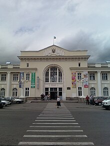
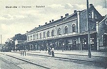
The Stryj – Ternopil railway is a branch line in Ukraine . It runs from Stryj , a regional center, via Chodoriw , a railway junction south of Lviv , to the oblast capital Ternopil .
The operation is led by the Ukrainian railways , in particular the Lvivska Salisnyzja . The entire line is single-track, the section from Stryj to Chodoriw is electrified.
history
Today's railway line consists of several former Austrian state railway lines, which were built in the 1890s by the kk Staatsbahnen (kkStB):
- State railway line Stryj – Chodorów , opened on December 22, 1899, length 41 kilometers
- State railway line Chodorów – Podwysokie , opened on November 29, 1897, length 42.7 kilometers
- State railway line Halicz – Ostrów-Berezowica (south of Ternopil), opened on January 25, 1897 (Podwysokie – Ostrów-Berezowica) and June 1, 1897 (Halicz – Podwysokie), length 72 kilometers + 29 kilometers
After the end of the Polish-Ukrainian War , the railway came under Polish rule and was now served by the Polish State Railways (PKP).
With the occupation of eastern Poland by the Soviet Union shortly after the start of the Second World War in 1939, the line came into the possession of the Soviet railways . These began immediately with the gauging of individual routes; but this was reversed after Germany's invasion of the Soviet Union in 1941 and the lines of the Eastern Railway were placed under the control. The route Stryj – Chodorow got the number 534g, the route Chodorow – Tarnopol got the number 534p.
The end of the Second World War brought eastern Poland to the Soviet Union with it, and under the leadership of the Soviet railways all standard-gauge railways were switched to broad gauge; since then, the railway line has been in broad gauge. During the retreat of the German troops from the area in 1944 they destroyed most of the routes; the severely damaged section of the Halytsch – Pidwyssoke route was never rebuilt.
literature
- Hermann Strach (Red.): History of the railways of the Austro-Hungarian monarchy. Vienna / Budapest 1898 ff. (Multi-volume standard work at the time)
Web links
- Route documentation Stryj – Chodoriw in pictures (Russian)
- Route documentation Chodoriw – Ternopil in pictures (Russian)
- Timetable of the connection between Stryi and Khodoriv, 2014
- Timetable for the Chodoriv-Ternopil connection, 2014
Individual evidence
- ↑ http://alex.onb.ac.at/cgi-content/alex?aid=rgb&date=18970004&seite=00000381
- ↑ http://alex.onb.ac.at/cgi-content/alex?aid=rgb&date=18960004&seite=00000359
- ↑ http://alex.onb.ac.at/cgi-content/alex?aid=rgb&date=18940004&seite=00000030
- ↑ http://www.pkjs.de/bahn/Kursbuch1944/Teil6/534c.jpg
- ↑ http://www.pkjs.de/bahn/Kursbuch1944/Teil6/534m.jpg


