Barguelonne
| Barguelonne | ||
|
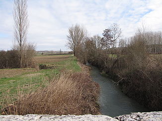
Upper reaches of the Barguelonne |
||
| Data | ||
| Water code | FR : O61-0400 | |
| location | France , Occitania region | |
| River system | Garonne | |
| Drain over | Garonne → Atlantic Ocean | |
| source | in the municipality of Pern 44 ° 20 ′ 20 ″ N , 1 ° 27 ′ 5 ″ E |
|
| Source height | approx. 245 m | |
| muzzle | on the municipal boundary of Golfech and Lamagistère in the Garonne Coordinates: 44 ° 7 ′ 5 ″ N , 0 ° 50 ′ 9 ″ E, 44 ° 7 ′ 5 ″ N , 0 ° 50 ′ 9 ″ E |
|
| Mouth height | approx. 50 m | |
| Height difference | approx. 195 m | |
| Bottom slope | approx. 3.2 ‰ | |
| length | 61 km | |
| Right tributaries | Petite Barguelonne | |
| Small towns | Valence | |
The Barguelonne (in the upper reaches also: Grande Barguelonne ) is a river in France that runs in the Occitanie region . It rises in the municipality of Pern , generally drains south-west and flows 61 kilometers southwest of Valence , after crossing under the Canal latéral à la Garonne , at the municipal boundary of Golfech and Lamagistère , as a left tributary into the Garonne . This is also where the Canal de Golfech , a shortcut channel of the Garonne, flows into the Garonne again after it has supplied the nearby Golfech nuclear power plant with cooling water.
On its way, the Barguelonne touches the Lot and Tarn-et-Garonne departments .
Places on the river
Individual evidence
- ↑ a b geoportail.gouv.fr (1: 16,000)
- ↑ a b The information on the length of the river is based on the information on the Barguelonne from SANDRE (French), accessed on February 1, 2010, rounded to full kilometers.
