Canal latéral à la Garonne
| Canal latéral à la Garonne | |
|---|---|
|
Course of the Canal latéral à la Garonne (green line) |
|
| Water code | FR : O --- 0032 |
| abbreviation | Canal de Garonne |
| location | France , Occitania and Nouvelle-Aquitaine regions |
| length | 196 km |
| Built | 1844 to 1856 |
| class | <I (after the fire of the Montech water wedge lift) |
| Beginning | Connection to the Canal du Midi in the urban area of Toulouse |
| The End | Confluence with the Garonne at Castets-en-Dorthe |
| Descent structures | 54 |
| Ports | Toulouse, Castelsarrasin , Moissac , Agen |
| Junctions, crossings | Canal de Montech , canalized Baïse |
| Used river | Garonne |
| Outstanding structures | Montech water wedge lift , Moissac and Agen canal bridges |
| Kilometrage | Towards the Atlantic |
| Downhill | following the course of the Garonne river |
| Canal bridge over the Garonne in Agen | |
The Canal latéral à la Garonne (German: Garonne-Seitenkanal ) is now usually only briefly referred to as Canal de Garonne (German: Garonne Canal) . Together with the Canal du Midi it forms a waterway, for which the generic term Canal des Deux Mers is sometimes used.
It is a navigable canal in France that was opened in 1856 as a bypass for the Garonne, which is difficult to navigate .
Course and technical infrastructure
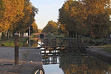
The canal runs from Toulouse , where it connects to the Canal du Midi and is connected to the Garonne via the short Canal de Brienne , in a north-westerly direction to Castets-en-Dorthe , about 45 kilometers south-east of Bordeaux . There it flows into the tidal Garonne after a distance of 196 kilometers . It is a canal of the side canal type , which follows the course of the Garonne River without its own apex . It initially stays parallel to the right bank of the river, but changes to the left side at Agen , where it remains up to its mouth. To overcome the height difference of 125 meters, 54 electrified and mostly fully automatic locks are in operation, which are dimensioned for ships in Freycinet dimensions.
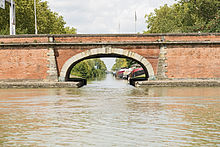
In its course, one encounters impressive constructions, for example the 539 meter long canal bridge over the Garonne in Agen , or the 350 meter long canal bridge over the Tarn near Moissac . More recently (commissioning 1973) is the first water wedge lift in the world, for bypassing the lock staircase at Montech by commercial shipping . However, the elevator had to be shut down after a fire in 2009. It is still unclear whether and when a repair will be carried out.
An 11-kilometer branch canal ( Canal de Montech ) leads from Montech to Montauban , where it connects to the Tarn River. In Buzet-sur-Baïse , the canal connects to the Baïse River .
Coordinates
- Starting point of the canal: 43 ° 36 ′ 40 ″ N , 1 ° 25 ′ 6 ″ E
- End point of the canal: 44 ° 33 ′ 50 ″ N , 0 ° 9 ′ 20 ″ W.
Crossed departments
in the Occitania region :
in the Nouvelle-Aquitaine region :
Places on the canal
History and characteristics

After Riquet had already thought of a continuation of "his" Canal du Midi in the direction of Bordeaux , the architect Vauban presented a first concrete project in 1665. However, it was not carried out. Other projects later emerged, but these too were not carried out, mainly due to difficulties with funding. The first work began in 1839, but was stopped again in 1844 because the credits were exhausted. Meanwhile, the canal project was in competition with the railways. The canal was therefore called into question again, and there was even thought of filling in the already excavated stretch. A new company then continued the work. In 1844 the section between Toulouse, Montech and Montauban was put into operation, in 1845 the Moissac Canal , Agen in 1849, the Baïse River in 1852 and Castets-en-Dorthe in 1856. The canal started operating almost 200 years after the Canal du Midi.
The canal today
The Canal latéral à la Garonne is practically no longer of any importance as a canal for freight. On the other hand, like many other canals, it has been increasingly used by water tourism with sport boats and houseboats since the 1970s , albeit much less intensively than the Canal du Midi. Boats can be rented at various locations along the canal; hotel and excursion boats also operate.
You can follow the canal along its entire length on a mostly wide, largely well-developed former towpath . Trees provide shade along most of the route, in places ancient, thick plane trees . Cyclists and hikers will find places with overnight accommodation, food and shopping facilities at short intervals.
Lock sequence
The following shows the course of the canal through its locks, starting at its eastern end. The name of the lock is given, followed by the number of barrages in this lock and the height it has overcome (all steps; + = upwards, - = downwards). The lock is then removed from the starting point of the waterway. Special features are described under Notes.

| Key name | stages | Hub | km | Remarks |
|---|---|---|---|---|
| - | - | 0.0 | Toulouse , Canal du Midi connection | |
| Lalande | 1 | - 2.91 m | 4.0 | |
| Lacourtensourt | 1 | - 2.57 m | 6.6 | |
| Fenouillet | 1 | - 2.25 m | 7.7 | |
| Lespinasse | 1 | - 2.58 m | 11.5 | |
| Bordeneuve | 1 | - 2.64 m | 13.4 | |
| Saint-Jory | 1 | - 2.56 m | 15.3 | |
| - | - | 18.5 | Canal bridge over the river Hers | |
| L'Hers | 1 | - 2.58 m | 18.6 | |
| Castelnau | 1 | - 2.56 m | 19.5 | |
| Bulging | 1 | - 2.69 m | 22.6 | |
| La Vache | 1 | - 2.51 m | 41.1 | |
| - | - | 43.1 | Canal de Montech junction | |
| Montech | 1 | - 2.67 m | 43.2 | Water wedge lift , out of order |
| Peyrets | 1 | - 2.60 m | 44.0 | Water wedge lift, out of order |
| Pellaborie | 1 | - 2.65 m | 44.3 | Water wedge lift, out of order |
| Escudiés | 1 | - 2.55 m | 44.7 | Water wedge lift, out of order |
| Pommies | 1 | - 2.68 m | 45.4 | Water wedge lift, out of order |
| Escatalens | 1 | - 2.65 m | 47.6 | |
| Saint Martin | 1 | - 2.54 m | 52.0 | |
| Prades | 1 | - 2.60 m | 55.5 | |
| Castelsarrasin | 1 | - 2.53 m | 57.8 | |
| Saint-Jean-des-Vignes | 1 | - 1.71 m | 59.2 | |
| Les Verriès | 1 | - 2.37 m | 59.6 | |
| Artel | 1 | - 2.72 m | 60.1 | |
| - | - | 62.0 | Canal bridge over the Tarn river (length: 356 meters) |
|
| Cacor | 1 | - 2.60 m | 62.8 | |
| Grégonne | 1 | - 2.60 m | 63.3 | |
| Moissac | 1 | - 2.30 m | 63.9 | |
| - | - | 64.0 | Branch to the Tarn river | |
| Espagnette | 1 | - 1.27 m | 67.5 | |
| Petit Bézy | 1 | - 2.62 m | 71.4 | |
| Braguel | 1 | - 2.34 m | 77.1 |


| Key name | stages | Hub | km | Remarks |
|---|---|---|---|---|
| Pommevic | 1 | - 2.37 m | 78.6 | |
| Valence-d'Agen | 1 | - 2.39 m | 80.5 | |
| - | - | 85.6 | Canal bridge over the Barguelonne river | |
| Lamagistère | 1 | - 2.35 m | 86.9 | |
| Le Noble | 1 | - 2.00 m | 93.7 | |
| Saint-Christophe | 1 | - 1.48 m | 96.9 | |
| - | - | 99.6 | Canal bridge over the Séoune river | |
| - | - | 108.7 | Canal bridge over the Garonne river (Length: 580 meters) |
|
| Agen | 1 | - 3.42 m | 109.5 | |
| Marianettes | 1 | - 2.96 m | 109.9 | |
| Chabrières | 1 | - 3.11 m | 110.3 | |
| rosette | 1 | - 2.88 m | 110.7 | |
| L'Auvignon | 1 | - 1.03 m | 125.3 | |
| - | - | 132.1 | Canal bridge over the river Baïse | |
| Baïse | 1 | - 2.53 m | 132.4 | |
| Larderet | 1 | - 2.44 m | 132.6 | |
| - | - | 135.2 | Branch to the river Baïse | |
| Berry | 1 | - 2.05 m | 143.0 | |
| La Gaule | 1 | - 2.03 m | 147.7 | |
| La Gaulette | 1 | - 2.00 m | 150.4 | |
| Mas-d'Agenais | 1 | - 1.01 m | 156.1 | |
| - | - | 18.5 | Canal bridge over the Avance River | |
| L'Avance | 1 | - 2.44 m | 166.0 | |
| Bernès | 1 | - 2.06 m | 171.1 | |
| Gravières | 1 | - 1.94 m | 173.6 | |
| L'Auriole | 1 | - 2.00 m | 181.1 | |
| Fontet | 1 | - 1.61 m | 183.7 | |
| Bassanne | 1 | - 1.73 m | 187.9 | |
| Mazerac | 1 | - 3.32 m | 192.3 | |
| Les Gares | 1 | - 3.29 m | 193.0 | |
| Castets | 2 | - | 193.6 | Lifting height depends on the water flow and tide level |
| - | - | 195.7 | Confluence with the Garonne |
literature
Morlot, Jean: Canaux du Midi. Carto-guide fluvial. 10e édition, 2006. Editor: Vagnon. ISBN 978-2-85725-511-6 .
Web links
- Information about the channel in the Babel project (French)
- Website of the channel (French)
Individual evidence
- ↑ a b The information on the length of the canal is based on the information on the Canal latéral à la Garonne from SANDRE (French), accessed on November 14, 2011, rounded to full kilometers
- ↑ PC-Navigo shows you the waterways The version from 2013 was used as the source.


