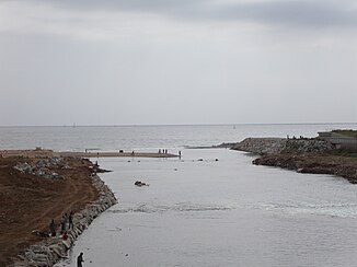
Besòs
| Besòs | ||
|
muzzle |
||
| Data | ||
| location | Barcelona Province , Catalonia , Spain | |
| River system | Besòs | |
| source | of Mogent and Congost near Montmeló 41 ° 32 ′ 47 ″ N , 2 ° 15 ′ 2 ″ E |
|
| muzzle | to the Mediterranean Sea Coordinates: 41 ° 25 ′ 7 ″ N , 2 ° 13 ′ 59 ″ E 41 ° 25 ′ 7 ″ N , 2 ° 13 ′ 59 ″ E |
|
| Mouth height |
0 m
|
|
| length | 53 km | |
| Big cities | Barcelona | |
| Medium-sized cities | Granollers , Mollet del Vallès , Santa Coloma de Gramenet , Sant Adrià de Besòs | |
The Besòs is a 53 km long river in northeastern Spain in the province of Barcelona . It rises at the confluence of the Mogent and Congost rivers in the comarca (district) Vallès Oriental and flows into the Mediterranean near the municipality of Sant Adrià de Besòs .
Its course leads through the towns of Aiguafreda , La Garriga , Les Franqueses del Vallès , Canovelles , Granollers , Montmeló , Mollet del Vallès , Montcada i Reixac , Santa Coloma de Gramenet , Sant Adrià de Besòs and Barcelona .
Tributaries
The Besòs has five main tributaries:
- Mogent ,
- Congost ,
- Tenes ,
- Riera de Caldes ,
- Ripoll
history
Although it was never navigable, it formed a link between the Catalan coast and the interior. It has been used for irrigation since the 10th century. Since it flows through a densely populated and industrialized area, it was considered the most contaminated river in Europe in the 1980s. It was cleaned and cleared in the mid 1990s.
gallery
Web links
- el Besòs. In: Gran Enciclopèdia Catalana (Catalan).


