Blanchard River
| Blanchard River | ||
|
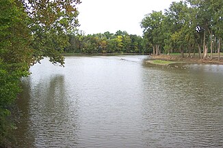
Blanchard River at Findlay |
||
| Data | ||
| Water code | US : 1065925 | |
| location | Ohio (USA) | |
| River system | Saint Lawrence River | |
| Drain over | Auglaize River → Maumee River → Niagara River → Saint Lawrence River → Atlantic Ocean | |
| source | 8 km northwest of Kenton 40 ° 39 ′ 26 ″ N , 83 ° 36 ′ 10 ″ W |
|
| Source height | 686 m | |
| muzzle | Auglaize River near Dupont Coordinates: 41 ° 2 ′ 29 " N , 84 ° 17 ′ 58" W 41 ° 2 ′ 29 " N , 84 ° 17 ′ 58" W |
|
| Mouth height | 209 m | |
| Height difference | 477 m | |
| Bottom slope | 5.1 ‰ | |
| length | 93 km | |
| Catchment area | 896 km² | |
|
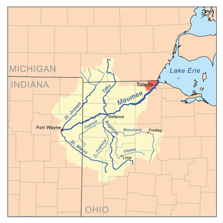
Map of the Blanchard River within the Maumee River basin. |
||
The Blanchard River is a 153 km long tributary of the Auglaize River in the northwest of the US state Ohio .
It predominantly drains agricultural land that lies in the catchment area of Lake Erie . It rises in central Hardin County about 8 km northwest of the village of Kenton and flows 40 km north to eastern Hancock County . Then it turns west, touches the cities of Findlay and Ottawa and flows into the Auglaize River around 3.2 km north of Cloverdale in western Putnam County .
The Blanchard River was named after Jean Jacques Blanchard , a French tailor who settled near the present-day town of Mount Blanchard in 1769 in the middle of the Shawnee on the river. He married a Shawnee woman and had seven children with her. In the war of 1812, General William Hull, commander of the Ohio troops, arranged for a road to be built up to the river for troop transport. Colonel James Findley built a fort for defense that was surrounded by palisades. The town of Findlay, which emerged in this area in 1815, was named after him.
The river floods regularly in spring. The first report of flood damage comes from the early 19th century, when residents had to flee to the orchards on the banks of the river. In 2007, 2008 and 2009 the river flooded the dams in Findlay more than a dozen times, damaging numerous residential and commercial buildings.
Name variants
The river has several designations:
- Blanchard Fork
- Blanchard's fork
- Blanchard's fork
- Quegh-tu-wa
- Quegh-tua-wa
- Queghtuwa
- Sha-po-qua-te-sepe
- Sha-po-qua-te-sepi
- Tailor's River
- Tailors River
Web links
Individual evidence
- ↑ a b Google Earth altitude for GNIS coordinates, accessed on July 23, 2010.
- ↑ a b c Blanchard River in the Geographic Names Information System of the United States Geological Survey
- ↑ a b Blanchard River History , accessed July 2010
- ↑ a b c d e f g Doctor HF Raup Ohio Place Names Research File
- ^ Colton, JH Ohio. New York, 1955
- ^ US Geological Survey . Geographic Names Phase I data compilation (1976-1981). 31-Dec-1981. Primarily from US Geological Survey 1: 24,000-scale topographic maps (or 1: 25K, Puerto Rico 1: 20K) and from US Board on Geographic Names files. In some instances, from 1: 62,500 scale or 1: 250,000 scale maps
- ↑ GeoNative. Accessed from www.geocities.com/Athens/9479. Useful for names in minority languages. Details includes date accessed. Wyandot / Sep 18, 2001

