
Blue Adriatic Sea (Rhineland-Palatinate)
| Blue Adriatic | ||
|---|---|---|

|
||
| Beach of the Blue Adriatic | ||
| Geographical location | Germany | |
| Location close to the shore | Ludwigshafen am Rhein | |
| Data | ||
| Coordinates | 49 ° 25 '33 " N , 8 ° 27' 44" E | |
|
||
| Altitude above sea level | 89 m above sea level NHN | |
| surface | 20 ha | |
| length | 650 m | |
| width | 350 m | |
| Maximum depth | 10 m | |
|
particularities |
Total size of the water ensemble> 1 km² |
|

The blue Adriatic on the boundaries of the Palatine local church Altrip ( Rhineland-Palatinate ) is a quarry pond , which the west Rhine along with smaller bodies of water next to a partially silted old Rhine loop , the Neuhöfer Old Rhine , the mining of gravel arose. At the same time, the Blue Adriatic is also the name of the entire local recreation area that was created around the lake landscape.
geography
Geographical location
The Blue Adria is located southeast of the city of Ludwigshafen in the middle between the residential development of Altrip in the east and that of Neuhofen in the west; both communities are each 1.5 km away.
reachability
The Blue Adriatic is reached from the north via an access road that branches off from the Ludwigshafen – Altrip road at the White House , and from the south via the Waldsee – Altrip road.
Characteristics
The entire water area takes up more than 1 km². The largest of the original quarry ponds is the actual Blue Adriatic Sea , which is 20 hectares and a maximum of 10 m deep . The remaining waters are the even larger Neuhöfer Altrhein and the smaller swan, hunter and carp ponds . The swan pond in the north and the carp pond in the south can also be seen as parts of the Blue Adriatic, each only separated from it by a narrow land bridge. In addition, there is the surrounding land area with 35 hectares, of which the developed beaches make up almost a third.
use
The multi-part local recreation area consists of the water and shore areas and contains the designated nature reserves 7338-013 Neuhofener Altrhein, 7338-066 Neuhofener Altrhein (northern extension) and 7338-185 Kistnerweiher . The Blue Adria quarry pond forms the heart of the site. There is a camping site, a freely accessible sandy beach monitored in summer by Johanniter-Unfall-Hilfe and the DLRG , as well as a kiosk and toilet. A DLRG rescue station (DLRG Altrip) is also stationed on the middle beach of the Neuhöfer Altrhein. On the tongue of land that extends into the lake, and on the "Island of Love", which can be reached via this headland walk is nudist usual.
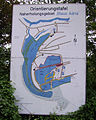
Orientation board

Entrance area of a private property on the middle lake

Neuhöfer Altrhein in winter


history
Before 1950 the area of the abandoned excavator ponds was neglected wasteland. The local recreation area was created in the 1950s on the initiative of a dentist from Heidelberg . At the time of the beginning of the German economic miracle , he wanted to offer vacation opportunities to those who had not yet been able to travel abroad. In response to the Adriatic holiday, which was becoming popular at the time , he founded the Blue Adriatic interest group , which took care of the cultivation of the waters' edges and the establishment of an infrastructure. Entrance fees are still not charged, but the approximately 2000 parking spaces are chargeable.
Initially it was planned to run a connecting clasp as a southern bypass of Ludwigshafen about 7 km to the east from the federal highways 9 ( Karlsruhe –Ludwigshafen) and 44 ( Frankfurt –Ludwigshafen), which currently meet at the Rheingönheimer Kreuz . There it was to be connected to the southern bypass of the Baden neighboring city of Mannheim by means of a new bridge over the Rhine in order to close the motorway ring around the two cities. With regard to the local recreation area near Altrip, the northern area of which the route would have crossed, this project was "finally" dropped in 2003 after decades of discussion; the planning approval decision was repealed and the project was deleted from the federal transport infrastructure plan. The reservation of the train path was also not included in the regional plan, which is valid until 2020. Since a realization in the distant future was described as possible in a footnote, the expansion of the Rheingönheim Cross is theoretically still open.
Web links
- Blue Adriatic at Urlaub-in-rheinland-pfalz.de
Individual evidence
- ↑ a b c Map service of the landscape information system of the Rhineland-Palatinate nature conservation administration (LANIS map) ( notes )
- ^ The Rhine Palatinate on Sunday, Palatinate edition . Ludwigshafen April 13, 2008.
- ^ The Rheinpfalz , local edition Rhein-Pfalz-Kreis . Ludwigshafen May 31, 2011.
- ^ The Rheinpfalz , local edition Rhein-Pfalz-Kreis . Ludwigshafen August 5th, 2011.