Borbeck Mühlenbach
|
Borbecker Mühlenbach Berlbach (historical), Mühlenbach (historical, local in the present) |
||
|
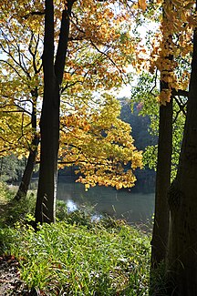
The artificial Margarethensee in the Grugapark is fed by the Borbeck mill stream. |
||
| Data | ||
| Water code | DE : 277284 | |
| location | Germany | |
| River system | Rhine | |
| Drain over | Berne → Emscher → Rhine → North Sea | |
| source | in Essen- Bredeney 51 ° 24 ′ 49 ″ N , 6 ° 59 ′ 14 ″ E |
|
| Source height | 148 m above sea level NHN | |
| muzzle | in the Berne , coordinates: 51 ° 29 ′ 19 ″ N , 6 ° 57 ′ 55 ″ E 51 ° 29 ′ 19 ″ N , 6 ° 57 ′ 55 ″ E
|
|
| length | 11.1 km | |
| Left tributaries | Sommerburgbach, Kesselbach, Rosendeller Bach | |
| Right tributaries | Stocksiepen, Salzerbach | |
| Big cities | Essen, Mülheim an der Ruhr | |
The Borbeck Mühlenbach is a left tributary of the Berne (Emscher) in Essen with a flow length of 11.1 kilometers.
River course
The Borbeck Mühlenbach rises in two sieves in Essen- Bredeney . The brook is passed under the A52 and Messe Essen and then flows through the Grugapark . In the park area it feeds the Margarethen and Waldsee lakes. Its direction of flow is oriented to the northwest after Grugapark, forming the city limits of Essen and Mülheim an der Ruhr for about one kilometer . At Essen- Schönebeck it changes its course to the northeast. Between Altendorf and Bochold , the creek forms a part of the district boundary, at the same time the south-eastern boundary of the Borbeck district. The Sälzerbach flows into the Bochold district from the right. Shortly after reaching the Essen district of Bergeborbeck, the Borbeck Mühlenbach flows into the Berne west of the Essen stadium .
Renaturation
In the middle and lower reaches of the stream was canalized and piped during industrialization. As part of the conversion of the Emscher system , it was planned to redesign the Borbeck Mühlenbach into a natural, clean water course. Wastewater is led to the Emscher Canal via a sewer constructed parallel to the stream. The canal should be completed in spring 2015. Since 2014, no more wastewater has been fed south of the A40. The stream itself has been renatured since 2010. The renovation work between the districts of Holsterhausen , Margarethenhöhe and Fulerum was completed in 2012. By September 2014, a still piped section of the stream between Fulerum, Frohnhausen , Holsterhausen and Margarethenhöhe was exposed.
For the further renaturation of the water in the densely populated urban area, the construction of an underground rainwater retention basin in the Frohnhausen district is necessary. The start of construction was delayed due to evidence of a particularly protected bird species, the water rail , at the planned location of the basin.
River history

Originally the Borbeck Mühlenbach was a direct tributary of the Emscher. Only when the water-richer Berne was transferred to the lower reaches of the Borbeck Mühlenbach during industrialization, this was changed by human hands.
There were several mills in the course of the water, as the name Mühlenbach already recorded in the first map of the first half of the 19th century suggests. The Bergmuehle nor the creek crossing Bergmuehle street reminds Bergeborbeck. Other mills were the Borgsmühle , the Bückmannsmühle , the Herbrüggenmühle and the Horler Mühle .
Where the Mühlenbach now flows to the north from the Grugapark and touches the grounds of the Essen University Hospital , the fire mill and the half-timbered house of Heinrich Hülsmann were once located . It was torn down in 1922 and the restaurant Zur Brandsmühle opened there. To the east of the restaurant was the mill pond and the mill house with the water wheel, which in 1937 collapsed due to dilapidation and was not rebuilt. A canoe pond had been created to the west of the restaurant where guests could go canoeing. In the summer of 1934 the pond was approved for bathing. The restaurant Zur Brandsmühle fell victim to the Second World War .
See also
Web links
Individual evidence
- ↑ Prussian General Staff Map 1: 86400, half graduation (1816–1847)
- ↑ a b c GeoServer of the state administration of North Rhine-Westphalia: Layer first recording 1836-1858
- ^ German basic map 1: 5000
- ↑ Topographical Information Management, Cologne District Government, Department GEObasis NRW ( Notes )
- ^ Emschergenossenschaft / Lippeverband: Essen: Borbecker Mühlenbach - The sewer is already there. (No longer available online.) April 17, 2014, formerly in the original ; Retrieved October 25, 2014 . ( Page no longer available , search in web archives ) Info: The link was automatically marked as defective. Please check the link according to the instructions and then remove this notice.
- ↑ DerWesten, FUNKE DIGITAL GmbH & Co. KG: Mühlenbach is further exposed. February 1, 2013, accessed October 17, 2014 .
- ↑ Note on radioessen.de from August 1, 2014
- ↑ DerWesten, FUNKE DIGITAL GmbH & Co. KG: Construction project: The rare water rail does not want to move in Essen. August 4, 2015, accessed October 24, 2015 .
- ↑ Ludwig Potthoff: From the source to the Berne, In: Essener Volkszeitung from April 9, 1939
- ^ Hugo Rieth: The Margarethenhöhe in old views . Zaltbommel, The Netherlands 1999, ISBN 978-90-288-6604-1 .


